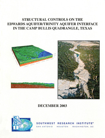
Structural Controls on the Edwards Aquifer/Trinity Aquifer Interface in the Camp Bullis Quadrangle, Texas

| Author | DA Ferrill, DW Sims, AP Morris, DJ Waiting, and N Franklin |
| Year | 2003 |
| Description | Structural analyses for geologic framework model of the area around the intersection of the Edwards and Trinity Aquifers |
| Publisher | CNWRA, Southwest Research Institute® |
| Location | Edwards Aquifer, Balcones Fault Zone, San Antonio Segment, Trinity Aquifer, Bexar County |
| Cover | View Download |
| File | View Download |
| Summary |
|
The purpose of this study was to generate a three-dimensional computer model and predictions of localized fault related deformation in the Edwards Aquifer and the Trinity Aquifer in the study area. The study also provided an analysis of the potential for hydraulic communication across the interface between the two aquifers, taking into account fault-related deformation and juxtaposition of the aquifers across key faults. The study was completed in December 2003 by Southwest Research Institute, San Antonio, Texas. [From the Summary] mechanisms and products of localized fault-related deformation in the Edwards and Trinity Aquifers in and near the study area. An important objective is to analyze the potential for communication between the Edwards Aquifer and the Trinity Aquifers, taking into account fault-related deformation and juxtaposition of the aquifers across key faults. Results of the project show the aquifer architecture throughout the study area, the location and interpreted geometry of the most important mapped faults in the study area, and the deformation In this geologic framework model, the Edwards and Trinity Aquifers are subdivided into seven stratigraphic horizons which are offset by a network of 40 faults. Vertical offset (fault throw) ranges from near zero to an approximate maximum of 110 meters (361 ft). Displacement sense is normal, commonly down to the southeast, and lateral displacement gradients are small. In map view, fault blocks are elongate, with the long axis oriented NE-SW. Maximum offset is concentrated along three fault systems, the southernmost of which forms the northern boundary of the aquifer recharge zone, where rocks of the Edwards Group are in faulted juxtaposition with Fault displacements within the Camp Bullis study area are too small to place the base of the Edwards Aquifer (Basal Nodular layer) against the permeable Lower Glen Rose layer. However, each fault decreases the effective aquifer thickness. This structural thinning of aquifer layers can cause flow constrictions, which in turn diverts flow and causes fluctuations in the local water table from fault block to fault block. Areas of such flow constrictions can be identified using a In the Castle Hills quadrangle, immediately south of the Camp Bullis quadrangle, several faults offset the Edwards Aquifer by distances equal to or greater than its full thickness. Smaller fault displacements in the Camp Bullis area and the northern part of the Castle Hills quadrangle reduce the amount of direct juxtaposition of Kainer against Lower Glen Rose in these areas to a minimum. The lack of fault juxtaposition of the recognized highly permeable units of the Edwards Group and Glen Rose Formation in the Camp Bullis and Castle Hills areas suggests that simple juxtaposition is not likely to be a major source of aquifer communication in this area. 3DStress™ analysis of measured faults, and regional stratigraphic thicknesses based on published maps yield a stress system during faulting of: vertical effective stress = 15 MPa; minimum horizontal effective stress (F3′) = 4 MPa with an azimuth of 150°; and an intermediate principal effective stress = 9.5 MPa. When applied to the fault surfaces exported from the three-dimensional Fault block deformation calculated using cutoff lines generated from the three-dimensional geologic framework model results in cutoff line elongations that rarely exceed 2% (positive or negative). These small cutoff elongations reflect the low displacement gradients on faults within the Camp Bullis study area. At the scale of the three-dimensional model, competent units exhibit gentle dips, which is consistent with relatively rapid lateral and vertical fault propagation, until intersection with other faults occurs (laterally) or intersection with a weaker mechanical layer occurs. This lack of steep lateral displacement gradients suggests rapid fault propagation with Field work reveals interesting contrasts between faults in the Edwards and Trinity Aquifers. Faults with displacements of 5 m (16 ft) to tens of meters in the Glen Rose Formation (Trinity Aquifer) commonly have damage zones with widths on the order of meters, within which small faults and rotated fault blocks are common. Although faults with displacements of 5 m (16 ft) to tens of meters in the Edwards Group limestones typically have numerous associated small faults, The large fault surfaces that cut multiple layers depicted in the Camp Bullis geologic framework model provide potential pathways for both vertical and lateral movement of water and hydraulic The structural analyses presented in this report provide the framework for more detailed investigations of groundwater levels, multiwell pumping (drawdown) tests, tracer studies, and geochemical investigations to further investigate potential groundwater communication between the Trinity and Edwards Aquifers in the Camp Bullis and Castle Hills Quadrangles. |
Search for Documents
Advance Search
Explore EAA's Scientific Reports
- All Reports
- Remote Sensing
- Precipitation
- Overview Studies
- Modeling
- Hydrology and Hydrogeology
- History
- Groundwater Recharge, Recharge Zone
- Groundwater Movement
- Geomorphology and Caves
- Weather Modification
- Geology
- Water Use and Conservation
- Geochemistry
- Water Resources Planning and Management
- Floods and Drought
- Water Quality
- Climatology
- Surface Water / Groundwater Relationship
- Biology
- Springs, Groundwater Discharge
- Archaeology
- RZ Protection
- Aquifer Levels
