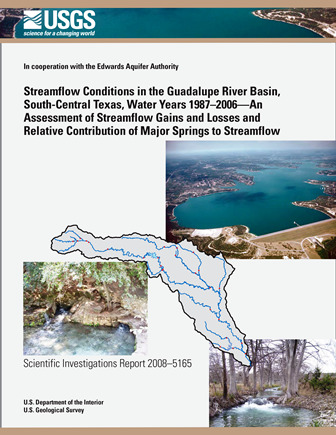
Streamflow Conditions in the Guadalupe River Basin, South-Central Texas, Water Years 1987-2006-An Assessment of Streamflow Gains and Losses and Relative Contribution of Major Springs to Streamflow

| Author | Ockerman DJ and Slattery RN |
| Year | 2008 |
| Description | Use of streamflow and springflow data to estimate contribution of springflow from Comal, San Marcos and Hueco Springs to streamflow in the Guadalupe River Basin |
| Report Number | USGS SIR 2008-5165 |
| Publisher | US Geological Survey |
| Location | Edwards Aquifer, Balcones Fault Zone, San Antonio Segment, Guadalupe River Basin |
| Cover | View Download |
| File | View Download |
| Summary |
|
The U.S. Geological Survey, in cooperation with the Edwards Aquifer Authority, assessed available streamflow data in the Guadalupe River Basin to determine streamflow gains and losses and the relative contribution of flow from major springs—Comal Springs, San Marcos Springs, and Hueco Springs—to streamflow in reaches of the Guadalupe River and its tributaries. The assessment is based primarily on long-term (1987–2006) and short-term (January 1999, August 1999, August 2000, and August 2006) streamflow conditions. For each analysis period, the ratio of flow from the major springs (measured at the spring source) to the sum of inflows (measured at the source of inflow to the river system) is computed for reaches of the Comal River and San Marcos River that include springflows from major springs, and for Guadalupe River reaches downstream from Canyon Dam. The ratio of springflow to the sum of inflows to the reach is an estimate of the contribution of flows from major springs to streamflow. For 1987–2006, the ratio of springflow from the major springs to the sum of inflows for the most upstream reach that includes inflow from all three major springs, Guadalupe River—above Comal River to Gonzales, is 27 percent. At the lowermost downstream reach, Guadalupe River—Bloomington to the San Antonio River, the percentage of the sum of inflows attributed to springflow is 18 percent. At that lowermost reach, the ratio of Canyon Lake releases to the sum of inflows was 20 percent. For the short-term periods August 2000 and August 2006 (periods of relatively low flow), springflow in the reach Guadalupe River—above Comal River to Gonzales accounted for 77 and 78 percent, respectively, of the sum of inflows in that reach. At the lowermost reach Guadalupe River—Bloomington to San Antonio River, springflow was 52 and 53 percent of the sum of inflows, respectively, during August 2000 and August 2006 (compared with 18 percent during 1987–2006); and during August 2000 and August 2006, the ratios of Canyon Lake releases to the sum of inflows were less than 10 percent (compared with 20 percent during 1987–2006). |
Search for Documents
Advance Search
Explore EAA's Scientific Reports
- All Reports
- Precipitation
- Overview Studies
- Modeling
- Hydrology and Hydrogeology
- History
- Groundwater Recharge, Recharge Zone
- Groundwater Movement
- Geomorphology and Caves
- Weather Modification
- Geology
- Water Use and Conservation
- Geochemistry
- Water Resources Planning and Management
- Floods and Drought
- Water Quality
- Climatology
- Surface Water / Groundwater Relationship
- Biology
- Springs, Groundwater Discharge
- Archaeology
- RZ Protection
- Aquifer Levels
- Remote Sensing
