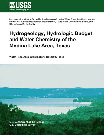
Hydrogeology, Hydrologic Budget and Water Chemistry of the Medina Lake Area, Texas

| Author | Lambert RB, Frimm KC and Lee RW (In cooperation with the Bexar-Medina-Atascosa Counties Water Control and Improvement District No. 1, Bexar Metropolitan Water District, Texas Water Development Board, and Edwards Aquifer Authority) |
| Year | 2000 |
| Description | Assessment of the geology, hydrogeology and hydrology of Medina and Diversion Lakes and seepage into the Edwards / Trinity aquifers |
| Report Number | USGS WRIR 2000-4148 |
| Publisher | US Geological Survey |
| Location | Medina Lake Area |
| Cover | View Download |
| File | View Download |
| Summary |
|
A three-phase study of the Medina Lake area in Texas was done to assess the hydrogeology and hydrology of Medina and Diversion Lakes combined (the lake system) and to determine what fraction of seepage losses from the lake system might enter the regional ground-water-flow system of the Edwards and (or) Trinity aquifers. Phase 1 consisted of revising the geologic framework for the Medina Lake area. Results of field mapping show that the upper member of the Glen Rose Limestone underlies Medina Lake and the intervening stream channel from the outflow of Medina Lake to the midpoint of Diversion Lake, where the Diversion Lake fault intersects Diversion Lake. A thin sequence of strata consisting primarily of the basal nodular and dolomitic members of the Kainer Formation of the Edwards Group, is present in the southern part of the study area. On the southern side of Medina Lake, the contact between the upper member of the Glen Rose Limestone and the basal nodular member is approximately 1,000 feet above mean sea level, and the contact between the basal nodular member and the dolomitic member is approximately 1,050 feet above mean sea level. The most porous and permeable part of the basal nodular member is about 1,045 feet above mean sea level. At these altitudes, Medina Lake is in hydrologic connection with rocks in the Edwards aquifer recharge zone, and Medina Lake appears to lose more water to the ground-water system along this bedding plane contact. Hydrologic budgets calculated during phase 2 for Medina Lake, Diversion Lake, and Medina/Diversion Lakes combined indicate that: (1) losses from Medina and Diversion Lakes can be quantified; (2) a portion of those losses are entering the Edwards aquifer; and (3) losses to the Trinity aquifer in the Medina Lake area are minimal and within the error of the hydrologic budgets. Hydrologic budgets based on streamflow, precipitation, evaporation, and change in lake storage were used to quantify losses (recharge) to the ground-water system from Medina Lake, Diversion Lake, and Medina/Diversion Lakes combined during October 1995–September 1996. Water losses from Medina Lake to the Edwards/Trinity aquifers ranged from -14.0 to 135 acre-feet per day; Diversion Lake ranged from -1.2 to 93.1 acre-feet per day; and Medina/Diversion Lakes combined ranged from 36.1 to 119 acre-feet per day. Monthly average recharge during December 1995–July 1996 was estimated using an alternative method developed during this study (current study method) and compared to monthly average recharge during December 1995–July 1996 estimated using the existing USGS method and the Trans-Texas method. Recharge to the Edwards aquifer estimated using the current study method was about 69 and 73 percent of the recharge estimated using the USGS and Trans-Texas methods, respectively. The USGS and Trans-Texas methods overestimated recharge from Medina Lake compared to the recharge estimated with the current study method when Medina Lake stage was between about 1,027 and 1,032 feet above mean sea level and underestimated recharge from Medina Lake when lake stage was between about 1,036 and 1,045 feet above mean sea level. The USGS and Trans-Texas methods underestimated recharge from Diversion Lake compared to the recharge estimated with the current study method when Diversion Lake stage was greater than 913 feet above mean sea level and overestimated recharge from Diversion Lake when lake stage was less than 913 feet above mean sea level. The water quality of Medina Lake and Medina River and in selected wells and springs in the Edwards and Trinity aquifers was characterized during phase 3 of the study. Environmental isotope analyses and geochemical modeling also were used to determine where water losses from the lake system might be entering the ground-water-flow system. Isotopic ratios of deuterium, oxygen, and strontium were analyzed in selected surface-water, lake-water, and ground-water samples to trace the isotopic “signature” of the lake water as it mixes with the ground water and to determine the fraction of lake water and ground water in selected Edwards aquifer wells. Isotopic data and geochemical modeling were used to show that lake water is moving into the Edwards aquifer in two fault blocks in the eastern Medina storage unit. One fault block is bounded on the north by the Vandenburg School fault and on the south by the Haby Crossing fault, and the second fault block is bounded on the north by the Diversion Lake fault and on the south by the Haby Crossing fault. In selected Edwards aquifer wells located southwest of Medina Lake and west of Diversion Lake, the proportion of lake water ranged from about 10 to 45 percent. Geochemical modeling using NETPATH confirms the degree of mixing between lake water and aquifer water shown by the isotopes. |
Search for Documents
Advance Search
Explore EAA's Scientific Reports
- All Reports
- Remote Sensing
- Precipitation
- Overview Studies
- Modeling
- Hydrology and Hydrogeology
- History
- Groundwater Recharge, Recharge Zone
- Groundwater Movement
- Geomorphology and Caves
- Weather Modification
- Geology
- Water Use and Conservation
- Geochemistry
- Water Resources Planning and Management
- Floods and Drought
- Water Quality
- Climatology
- Surface Water / Groundwater Relationship
- Biology
- Springs, Groundwater Discharge
- Archaeology
- RZ Protection
- Aquifer Levels
