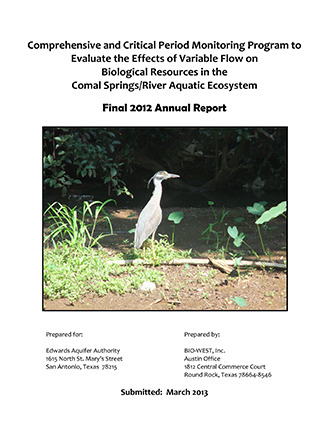
Comprehensive and Critical Period Monitoring Program to Evaluate the Effects of Variable Flow on Biological Resources in the Comal Springs/River Aquatic Ecosystem Final 2012 Annual Report

| Summary |
|
[From the Executive Summary] This annual summary report presents a synopsis of methodology used and an account of sampling activities conducted during two Comprehensive Monitoring efforts on the Comal Springs/River ecosystem in 2012. For ease of comparison, the data are reported here in an annual report format similar to previous reports (BIO-WEST 2001-2012). The drought in Central Texas continued through 2012 and flows in the Comal River were below the historic average for the entire year. A minimum flow of 155 cubic feet per second (cfs) was reached in September, and it was the lowest minimum flow since the first year of this study (2000). With rain events few and far between, flows stayed near 200 cfs for the remainder of 2012. Although water temperatures remained constant in spring runs and Landa Lake, hot and dry conditions led to water temperatures in the mouth of Blieder’s Creek that exceeded the state water quality standard for the Comal River (26.7 °C). Monitoring by Texas Master Naturalists continued to confirm that dissolved carbon dioxide (CO2) decreases and pH increases with distance from spring inputs. However, values for these parameters were similar to those observed in previous years. Recreation pressure was highest at the New Channel during the summer months, and was relatively low year-round at all other monitored sites. Monitoring of aquatic vegetation during these prolonged droughts is important to understanding potential impacts to fountain darter (Etheostoma fonticola) habitat. Bryophytes (mosses) hold high densities of fountain darters and can be abundant within the Upper Spring Run Reach. This was the case in spring, but by fall many of the bryophytes had died likely due to shading by green algae that often bloom in summer with abundant sunlight. Sagittaria continued to be stable in the lower half of the reach. Bryophytes are also an important component of the upper section of the Landa Lake Reach. Unlike the Upper Spring Run Reach, bryophytes at Landa Lake remained relatively constant over the entire year. Cabomba, another native plant with relatively high densities of darters has been increasing in coverage in Landa Lake, and by fall 2012 had the highest coverage observed in this study. Lower than average flows did not appear to negatively affect aquatic vegetation in the Landa Lake Reach in 2012. The Old Channel Reach exemplifies the interaction between native (Ludwigia) and non-native (Hygrophila) vegetation. Over the past several years Ludwigia has become sparse (filamentous algae is rarely present) while Hygrophila has come to dominate most of the reach. Cabomba flourished in the New Channel Reach in 2012, while coverage of Hygrophila was only slightly less in this scour-prone reach. A high-flow event (7,280 cfs) in 2010 scoured out much of the vegetation in upper reaches of the Comal River resulting in low population estimates of fountain darters; however, by 2012 aquatic vegetation had recovered and fountain darter population estimates were similar to years prior to the flood. Estimates in the Upper Spring Run Reach decreased considerably from spring to fall due to the loss of bryophytes (which appears to be a regular cycle). These bryophytes hold the highest densities of fountain darters in the Comal River. Of non-native aquatic vegetation, Hygrophila holds the highest densities of darters. Length-frequency distribution indicates that higher quality habitats exhibit year-round reproduction, whereas lower quality habitats (i.e., Hygrophila) typically only exhibit a spring reproductive peak. This may be tied to fountain darter spawning preferences, as other studies suggest that egg deposition in native vegetation is higher than in non-native vegetation (Phillips et al. 2011). Catches of exotic giant ramshorn snail (Marisa cornuarietis) have increased in 2011 and 2012. It is unclear if this is related to the ongoing drought, but monitoring will help determine if they are impacting aquatic vegetation. Additionally, continued monitoring of giant ramshorn snail will aid in evaluating the success of Edward’s Aquifer Habitat Conservation Plan (EAHCP) measures aimed at controlling this exotic species. Comal Springs salamander (Eurycea sp.) counts appeared to be increasing during 2012 following the post-flood decline in 2011 (the lowest during the study period). Few salamanders continue to be found at the Spring Island Spring Run, but this is likely a result of lower quality habitat compared to other reaches. A total of 749 Comal Springs Riffle Beetles (Heterelmis comalensis) were observed on cotton lures in 2012, the lowest total since 2003. Fewer have been found at Spring Island since the flood of 2010 because spring outlets have shifted locations, and riffle beetles may have moved. The flood of 2010 impacted the biota and associated habitat in the Comal River, but monitoring efforts in 2012 indicate that much of the system has recovered. Aquatic vegetation is flourishing in all reaches, and fountain darter populations are similar to pre-flood estimates. The interaction between native and non-native vegetation will continue to be an important driver of fountain darter populations. As EAHCP efforts get under way in 2013, including aquatic vegetation restoration and non-native species control, continued monitoring is more important than ever to assess effectiveness of EAHCP activities. |
Search for Documents
Advance Search
Explore EAA's Scientific Reports
- All Reports
- History
- Groundwater Recharge, Recharge Zone
- Groundwater Movement
- Geomorphology and Caves
- Weather Modification
- Geology
- Water Use and Conservation
- Geochemistry
- Water Resources Planning and Management
- Floods and Drought
- Water Quality
- Climatology
- Surface Water / Groundwater Relationship
- Biology
- Springs, Groundwater Discharge
- Archaeology
- RZ Protection
- Aquifer Levels
- Remote Sensing
- Precipitation
- Overview Studies
- Modeling
- Hydrology and Hydrogeology
