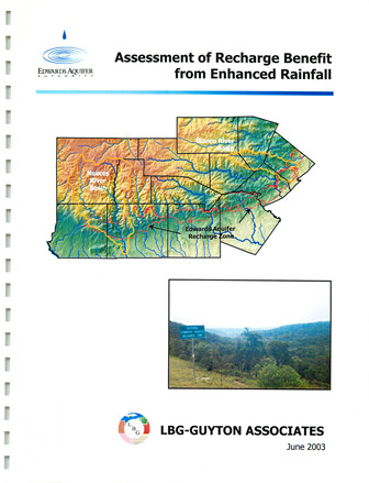
Assessment of Recharge Benefit from Enhanced Rainfall

| Author | LBG-Guyton Associates |
| Year | 2003 |
| Description | Using the HSPF model to estimate recharge in the Blanco and Nueces River basins from the Edwards Aquifer Authority Precipitation Enhancement Program in 1999-2001 |
| Publisher | LBG-Guyton Associates |
| Location | Blanco River Basin, Nueces River Basin |
| Cover | View Download |
| File | View Download |
| Summary |
|
LBG-Guyton Associates has used pilot recharge models (developed using HSPF (Hydrologic Simulation Package Fortran)) for the Nueces and Blanco River basins to estimate the total amount of increased recharge to the Edwards aquifer during the 1999, 2000, and 2001 Precipitation Enhancement Program (PEP) seasons. Woodley Weather Consultants (WWC)(2002) provided estimates of rainfall and seeding-induced rainfall increments for the Nueces and Blanco basins during the 1999, 2000, and 2001 seasons. These estimates of increased precipitation were used as a basis for simulating the impact of the PEP on aquifer recharge. Modeling results indicate the total increased aquifer recharge during 1999, 2000, and 2001 in the Nueces basin was 663, 655 and 654 acre-feet per year respectively, which represents a 0.45, 0.34 and 0.19 percent per year increase respectively. The total increased recharge during the three-year period was 1,972 acre-feet, or 0.29 percent in the Nueces basin. In the Blanco basin, the increased aquifer recharge was 152, 179, and I ,00 I acre- feet per year respectively, which represents a 0.44, 0.56, and 1.92 percent per year increase respectively for the Blanco basin. The total increased aquifer recharge during the three-year period was I ,332 acre-feet, or 1.13 percent in the Blanco basin. About half of the Nueces basin is in the c loud seeding zone, which may have reduced the impact of the PEP with regard to aquifer recharge in that basin. WWC (2002) indicates that the enhanced precipitation during the 1999, 2000, and 2001 seasons could have been increased if more cloud seeding had been performed. To simulate the effect of potentially greater enhanced precipitation, Scenario I was simulated. Scenario I assumed that the enhanced precipitation was equal to one inch on each of the days for which cloud seeding was considered successful (i.e., five days for Nueces basin and eight days for Blanco basin during the 3-year period). Scenario I modeling results indicate that the total increased aquifer recharge during 1999, 2000, and 2001 in the Nueces basin was 4, 123, 754, and 2,029 acre-feet per year respectively, which represents a 2.8, 0.4, and 0.6 percent per year increase respectively in the total recharge for the Nueces basin. The total increased recharge during the three-year period was 6,906 acre-feet, or 1.0 percent in the Nueces basin. In the Blanco basin, the increased aquifer recharge was I ,717, 550, 2,828 acre-feet per year respectively, which represents a 5.0, 1.7, 5.5 percent per year increase respectively in the total recharge for the Blanco basin. The total increased aquifer recharge during the three-year period was 5,095 acre-feet, or 4.2 percent in the Blanco basin. Limitations and assumptions of the modeling methodology are discussed in this report. Important factors affecting the evaluation of the PEP are the spatial and temporal accuracy of the precipitation data and the inability of the pilot models to simulate hydrology in the contributing zones of the watersheds that recharge the aquifer. In order to evaluate the PEP in the future, it is recommended that appropriate resources be applied to collecting and evaluating precipitation data, especially during the PEP season. In addition, future models should simulate the hydrology of the entire watershed instead of j ust the recharge zone. |
Search for Documents
Advance Search
Explore EAA's Scientific Reports
- All Reports
- Precipitation
- Overview Studies
- Modeling
- Hydrology and Hydrogeology
- History
- Groundwater Recharge, Recharge Zone
- Groundwater Movement
- Geomorphology and Caves
- Weather Modification
- Geology
- Water Use and Conservation
- Geochemistry
- Water Resources Planning and Management
- Floods and Drought
- Water Quality
- Climatology
- Surface Water / Groundwater Relationship
- Biology
- Springs, Groundwater Discharge
- Archaeology
- RZ Protection
- Aquifer Levels
- Remote Sensing
