 Conditions
Science & Data Document Library
Science and Data Resources
The Water Source
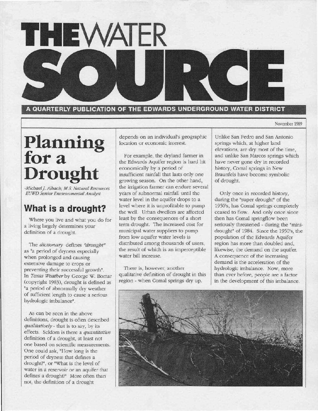
Description: Features and summaries of news and scientific studies published by the Edwards Underground Water District from 1989-1996
Location: Edwards Aquifer, Balcones Fault Zone, San Antonio Segment
Summary:Features and summaries of news and scientific studies published by the Edwards Underground Water District from 1989-1996
HSPF Recharge Models for the San Antonio Segment of the Balcones Fault Zone of the Edwards Aquifer Part 3

Description: Development of complete contributing and recharge zones for the HSPF enhancement to MODFLOW from historical data on all nine drainage basins of the Edwards Aquifer Balcones Fault Zone San Antonio Segment - Part 3
Report Number: 02-87-AS
Location: Edwards Aquifer, Balcones Fault Zone, San Antonio Segment, Contributing Zone, Recharge Zone
Summary:Note: This document is Part 3 of 3 parts.
The purpose of this study was to develop a new method for estimating recharge to the Edwards Aquifer. The computer program Hydrologic Simulation Program Fortran (HSPF) was used to develop a comprehensive recharge estimation model for the region. A previously completed pilot study project modeled portions of two of the nine basins applicable to the Edwards Aquifer. The pilot study indicated HSPF as a viable tool for recharge estimation and led to the initiation of this project. This project developed recharge models for all nine basins relevant to the Edwards Aquifer, by modeling the upstream (drainage) area, as well as the recharge zone of the aquifer. The project was completed in March 2005 by LBG Guyton Associates, Inc., Austin, Texas.
[From the Executive Summary]
Hydrologic models have been developed for the nine basins that recharge the San Antonio section of the Edwards Aquifer and recharge estimates from these models have been implemented into recharge data for the Edwards Aquifer MODFLOW model. The models have been calibrated for the basins of the (1) Nueces/West Nueces Rivers, (2) Frio/Dry Frio Rivers, (3) Sabinal River, (4) area between Sabinal and Medina River (Seco and Hondo Creeks), (5) Medina River, (6) area between Medina and Cibolo (San Geronimo, Helotes, and Salado Creeks), (7) Cibolo/Dry Comal Creeks, (8) Guadalupe River, and (9) Blanco River.
The main objective of the project was to develop hydrologic simulation models for the entire contributing and recharge zone of the Edwards Aquifer with the main focus being to estimate historical recharge to the Edwards Aquifer from 1950 through 2000. In addition to estimating
recharge, secondary objectives of the project were to ensure that the models were compatible with the future goals of assessing issues important to the Authority and other stakeholders, including water quality, land use changes, weather modification, brush control, recharge dams, and flood control. To achieve these goals, the entire contributing zone (above the Edwards aquifer recharge zone) of each of the nine basins was incorporated into the models.
The HSPF models are valuable tools for simulating the hydrology of the nine basins and assessing recharge under various hydrologic conditions. The models provide a new tool for assessing hourly hydrology, which could not be done with the traditional methods. They simulate each basin more discretely than the traditional methods do; which makes the models more appropriate for evaluating recharge enhancement, water quality and many other technical and regulatory issues.
To improve the accuracy of the models, more detailed field studies should be completed in selected areas of the recharge zone. These assessments should include field-scale rainfall-runoff and evaporation studies, tracer studies, channel loss studies, and other evaluations. Suggested model improvements include incorporating more detailed precipitation data from Authority rain gages that has been collected since this study was initiated; estimating model parameters by developing models for smaller watersheds; and enhancing the existing models to simulate water quality.
Summary Information Regarding Historical Edwards Aquifer Recharge, Aquifer Modeling and Recharge Enhancement Projects
Description: Compilation of historical reports by HDR Engineering on recharge and modeling of the Edwards Aquifer Balcones Fault Zone San Antonio Segment
Location: Edwards Aquifer, Balcones Fault Zone, San Antonio Segment, Recharge Zone
Summary:Compilation of historical reports by HDR Engineering on recharge and modeling of the Edwards Aquifer Balcones Fault Zone San Antonio Segment
HSPF Recharge Models for the San Antonio Segment of the Balcones Fault Zone of the Edwards Aquifer Part 2

Description: Development of complete contributing and recharge zones for the HSPF enhancement to MODFLOW from historical data on all nine drainage basins of the Edwards Aquifer Balcones Fault Zone San Antonio Segment - Part 2
Report Number: 02-87-AS
Location: Edwards Aquifer, Balcones Fault Zone, San Antonio Segment, Contributing Zone, Recharge Zone
Summary:Note: This document is Part 2 of 3 parts.
The purpose of this study was to develop a new method for estimating recharge to the Edwards Aquifer. The computer program Hydrologic Simulation Program Fortran (HSPF) was used to develop a comprehensive recharge estimation model for the region. A previously completed pilot study project modeled portions of two of the nine basins applicable to the Edwards Aquifer. The pilot study indicated HSPF as a viable tool for recharge estimation and led to the initiation of this project. This project developed recharge models for all nine basins relevant to the Edwards Aquifer, by modeling the upstream (drainage) area, as well as the recharge zone of the aquifer. The project was completed in March 2005 by LBG Guyton Associates, Inc., Austin, Texas.
[From the Executive Summary]
Hydrologic models have been developed for the nine basins that recharge the San Antonio section of the Edwards Aquifer and recharge estimates from these models have been implemented into recharge data for the Edwards Aquifer MODFLOW model. The models have been calibrated for the basins of the (1) Nueces/West Nueces Rivers, (2) Frio/Dry Frio Rivers, (3) Sabinal River, (4) area between Sabinal and Medina River (Seco and Hondo Creeks), (5) Medina River, (6) area between Medina and Cibolo (San Geronimo, Helotes, and Salado Creeks), (7) Cibolo/Dry Comal Creeks, (8) Guadalupe River, and (9) Blanco River.
The main objective of the project was to develop hydrologic simulation models for the entire contributing and recharge zone of the Edwards Aquifer with the main focus being to estimate historical recharge to the Edwards Aquifer from 1950 through 2000. In addition to estimating
recharge, secondary objectives of the project were to ensure that the models were compatible with the future goals of assessing issues important to the Authority and other stakeholders, including water quality, land use changes, weather modification, brush control, recharge dams, and flood control. To achieve these goals, the entire contributing zone (above the Edwards aquifer recharge zone) of each of the nine basins was incorporated into the models.
The HSPF models are valuable tools for simulating the hydrology of the nine basins and assessing recharge under various hydrologic conditions. The models provide a new tool for assessing hourly hydrology, which could not be done with the traditional methods. They simulate each basin more discretely than the traditional methods do; which makes the models more appropriate for evaluating recharge enhancement, water quality and many other technical and regulatory issues.
To improve the accuracy of the models, more detailed field studies should be completed in selected areas of the recharge zone. These assessments should include field-scale rainfall-runoff and evaporation studies, tracer studies, channel loss studies, and other evaluations. Suggested model improvements include incorporating more detailed precipitation data from Authority rain gages that has been collected since this study was initiated; estimating model parameters by developing models for smaller watersheds; and enhancing the existing models to simulate water quality.
Method of Estimating Natural Recharge to the Edwards Aquifer in the San Antonio Area, Texas
Description: US Geological Survey method of estimating recharge in the Edwards Aquifer Balcones Fault Zone San Antonio Segment
Report Number: USGS WRIR 78-10
Location: Edwards Aquifer, Balcones Fault Zone, San Antonio Segment
Summary:Estimates of annual recharge to the Edwards aquifer in the San Antonio area, Texas, have been made by several investigators as part of the long-term studies of the aquifer by the U.S. Geological Survey under agreements with several local cooperators .
The method of estimating annual recharge is based on data collected from a network of stream-gaging stations and on assumptions related to applying the runoff characteristics from gaged areas to ungaged areas.
The basic approach is a water-balance equation, in which recharge within a stream basin is the difference between measured streamflow above and below the infiltration area of the aquifer plus the estimated runoff in the zone that includes the infiltration area. Recharge in the Medina River basin also includes seepage losses from Medina Lake and Diversion Reservoir.
Gaging stations are located above and below the infiltration area in five of the nine basins that have .been delineated. Gaging stations above and below the infiltration area are located in parts of the other four basins. Parts of two basins have stations only at points below the infiltration area, and parts of the other two basins have no gaging sites at all.
The principal errors in the estimates of annual recharge are related to errors in estimating runoff in ungaged areas, which represent about 30 percent of the infiltration area. The estimated long-term average annual recharge in each basin, however, is probably representative of the actual recharge because the averaging procedure tends to cancel out the major errors.
Edwards Aquifer Authority Rain Gauge Analysis Study Report
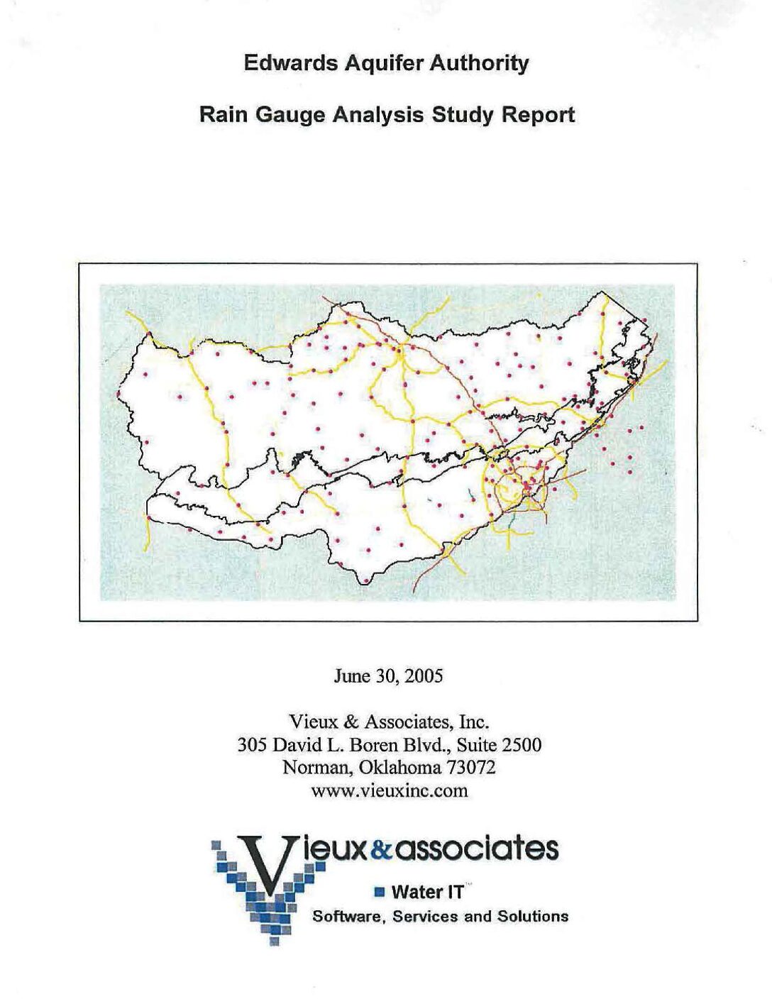
Description: Recommendations for optimizing placement of rain gauges in the Edwards Aquifer area
Location: Edwards Aquifer, Balcones Fault Zone, San Antonio Segment
Summary:The purpose of this report is to identify improvements to the rain gauge network that will increase the usefulness and accuracy of rainfall monitoring over the Edwards Aquifer Area (EAA). The proposed rain gauge networks are intended to provide more evenly distributed coverage over the aquifer area and for use in radar calibration. The existing gauge network of 61 EAA gauges in combination with the 41 gauges in the Guadeloupe [sic] Blanco River Authority (GBRA) network provides an average density of one gauge per 87 mi2 and a mean inter-gauge spacing that varies from 7 to 15 mi2 depending on the zone. Some zones, such as the Artesian Zone, have fewer gauges than other zones. Proposed new gauge locations are confined to easily accessible roadway locations to reduce access and operations costs.
The proposed rain gauge network achieves a density of one gauge per 66 mi2 with a uniform inter-gauge spacing of 8 mi2. An Alternative Configuration that relies on a private network of gauges achieves an improved density of one gauge per 55 mi2 with higher densities in and around San Antonio. Using the private network requires fewer new gauges to be installed. With the proposed additional gauges, more uniform coverage among zones, increased gauge density, and reduced inter-gauge spacing is achieved. With the addition of gauges, improvement in radar rainfall accuracy will be greatest in areas where few gauges existed. Analysis of the historical rain gauge performance revealed which gauges could be improved through maintenance actions. Correcting the twenty-one gauges rated as Suspect or Poor would help improve one-third of the existing gauges in the rain gauge network (RGN). The recommended maintenance actions and adjustments to the gauge network configuration will improve the quality and usefulness of the rain gauge data and benefit the accuracy of radar rainfall.
Ground-Water Recharge to the Edwards and Associated Limestones, San Antonio Area, Texas, 1964
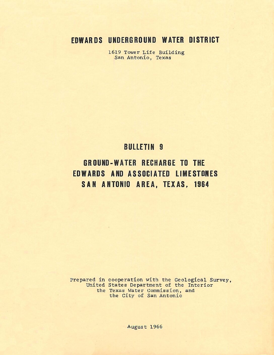
Description: Report for 1964 on estimated recharge to the Edwards Aquifer issued by the Edwards Underground Water District
Report Number: Bulletin 9
Location: Edwards Aquifer - San Antonio Area
Summary:The progress report from which recharge data for 1964 is taken is in the process of being printed and should be available in the near future. Therefore, only the estimated recharge for 1964 and average for the period 1934 1964 are shown.
For the third consecutive year the recharge is less than the average for the period of record , but 1964 recharge was about two and one-half times as much as for 1963 which was the lowest since 1956.
Recharge Enhancement Study Guadalupe-San Antonio River Basin Volume II-Technical Report
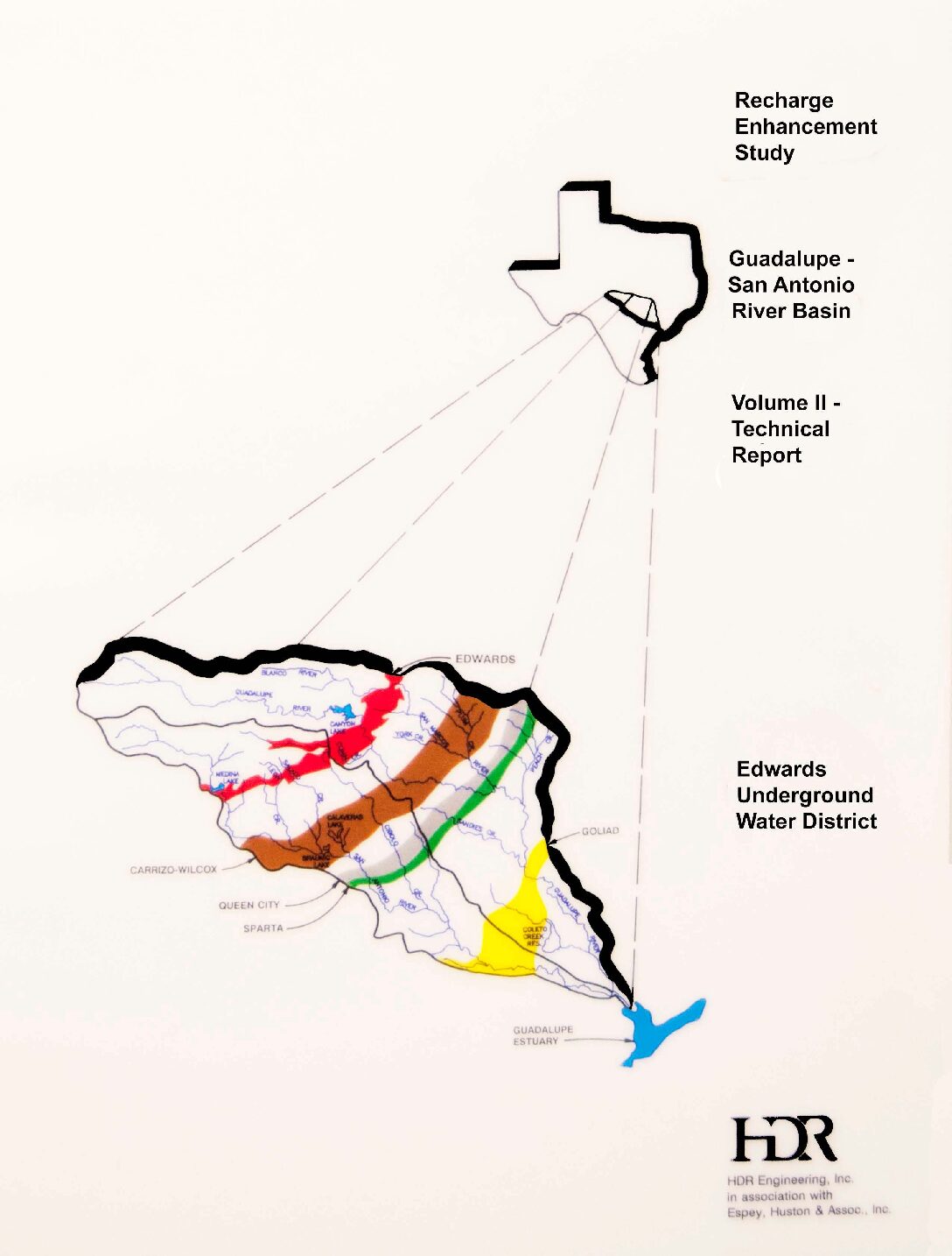
Description: Technical Report for Recharge Enhancement Study Guadalupe-San Antonio River Basin. See companion documents.
Location: Guadalupe River Basin, San Antonio River Basin
Summary:Technical Report for Recharge Enhancement Study Guadalupe-San Antonio River Basin. See companion documents.
Recharge Enhancement Study Guadalupe-San Antonio River Basin Volume I-Executive Summary
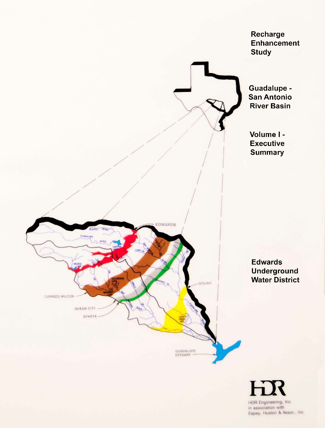
Description: Development of the GSA Model to estimate recharge to the Edwards Aquifer from the San Antonio and Guadalupe River basins and effects of additional recharge structures
Location: Guadalupe River Basin, San Antonio River Basin
Summary:The key objectives of the Guadalupe San Antonio River Basin Recharge Enhancement Study are summarized as follows:
- Development of new monthly estimates of historical Edwards Aquifer recharge consistent with those for the Nueces River Basin, thereby completing recharge estimates for the entire aquifer for the 1934-89 historical period.
- Development of a river basin computer model capable of evaluating recharge enhancement projects and water availability subject to variable water rights constraints and springflows.
- Calculation of maximum enhanced recharge potential and estuarine inflow reductions associated with a program of recharge projects subject to a range of springtlow and water rights utilization scenarios.
- Calculation of maximum water potentially available at selected locations subject to a range of springflow and water rights utilization scenarios.
Conclusions
Significant study findings and conclusions are as follows:
The potential for recharge enhancement estimated in this report is a theoretical maximum and, on more detailed review, will likely be subject to significant reductions due to economic, environmental, structural, and political limitations. When analyzed as a part of a total regional water resources program, there may be other types of water resource projects which provide greater benefits than some of the projects identified in this report.
Recharge of the Edwards Aquifer in the Guadalupe San Antonio River Basin may be increased by an average of about 123,000 ac-ft/yr if all structural and operational projects identified in this report are implemented and all water rights are honored. This represents an increase of about 38.5 percent in the historical average recharge. Recharge during the 10-year drought period from 1947 through 1956 could be increased by about 66,300 ac-ft/yr or 43.3 percent of the historical average during this period.
When the structural and operational programs identified are fully implemented, inflows to the Guadalupe Estuary will be reduced by an average of about 53,200 ac-ft/yr. The construction of only the structural program will reduce inflows by about 31,000 ac-ftjyr. These figures represent between 3.4 and 2.0 percent of the average annual flow of the Guadalupe and San Antonio Rivers into the Guadalupe Estuary.
Estimates of recharge enhancement associated with the structural and operational programs are not very sensitive to the various aquifer pumpage/springflow scenarios or to the degree of water rights utilization. Recharge enhancement is typically limited by the volume of runoff reaching each site and the physical capability to impound and recharge that runoff.
Potentially significant quantities of water may be available in the San Marcos River below the Blanco River confluence, in the Guadalupe River below the Comal River confluence, and in Canyon Lake for recharge enhancement or other uses. Theoretical maximum quantities of water available have been presented in this report for a range of assumptions as to Edwards Aquifer pumpage/springflow and utilization of existing water rights.
Methods used in this study to calculate historical recharge to the Edwards Aquifer result in estimates that differ from previous estimates by the USGS. In particular, there are significant differences at Medina Lake and Diversion Lake (HDR estimates are lower), the area between the Medina River and Cibolo Creek (HDR estimates are higher), and the upper San Marcos River watershed (HDR estimates are higher).
In addition, the methods used in this study show that significant recharge does occur in the Guadalupe River Basin where previous estimates by the USGS do not consider recharge in this basin.
Recommendations
The findings of this study indicate that recharge to the Edwards Aquifer may be substantially enhanced by the construction of additional recharge structures and/or changes in existing operational and institutional constraints. In order to determine whether these projects and/or operational changes are truly feasible and to quantify potential benefits to well yields and springflows, the following additional work is recommended:
Information developed in this study should be analyzed as a part of a total regional water resources program which compares the relative merits of recharge enhancement to other water supply options. After the role of recharge is determined in the regional water resources planning effort, selected recharge projects should be carried forward for additional detailed study.
The Texas Water Development Board model of the Edwards Aquifer should be recalibrated using the recharge values developed in this study and used to evaluate the various recharge options under consideration for the Nueces and Guadalupe San Antonio River Basins to determine benefits to well yields and springflows.
Significant numbers of additional streamgages and raingages should be added to the hydrologic data collection network to more accurately calculate recharge in ungagged areas and to significantly improve the accuracy of recharge estimates in areas directly over the recharge zone. A state-of-the-art recharge calculation methodology for the Edwards Aquifer should be developed which utilizes the additional streamgages and raingages and incorporates appropriate elements of the USGS and HDR procedures.
It is expected that consideration of these state-of-the-art recharge estimates will result in significant improvement in aquifer model calibration. The TWDB Edwards Aquifer model and the surface water/recharge models of the Nueces and Guadalupe San Antonio River Basins should be combined into one model to fully evaluate recharge enhancement options and to aid in the evaluation of various aquifer and surface water management alternatives.
Benefit/cost analyses of recharge projects (and/or operational changes) should be performed in detailed studies considering economic, environmental, geological, institutional, and structural feasibility of individual projects as well as combinations of projects.
Special hydrologic studies addressing the following specific items should be undertaken in support of improved recharge estimates:
Field studies of Medina Lake and Diversion Lake to better understand and define relationships between reservoir levels and recharge and leakage rates;
Field studies of water exchange rates between the Edwards Aquifer and the Guadalupe River downstream of Canyon Lake over a range of aquifer water levels;
Refinement of firm yield estimates for Canyon Lake to include consideration of water delivery losses in conjunction with Edwards Aquifer pumpage/springflow scenarios and potential subordination of hydroelectric rights;
Consideration of new geologic mapping of Bexar, Comal, and Hays Counties nearing completion by the USGS which should result in improved recharge zone definition and more accurate recharge basin drainage areas; and
Investigation of the possibility of calculating historical total daily flow estimates (including flows which are not springflows) for the USGS San Marcos River springflow gage to provide more accurate historical recharge estimates for the upper San Marcos River watershed. This is similar to the procedure used at the USGS Comal River gage.
Recharge Enhancement Study Guadalupe-San Antonio River Basin Volume III-Appendices
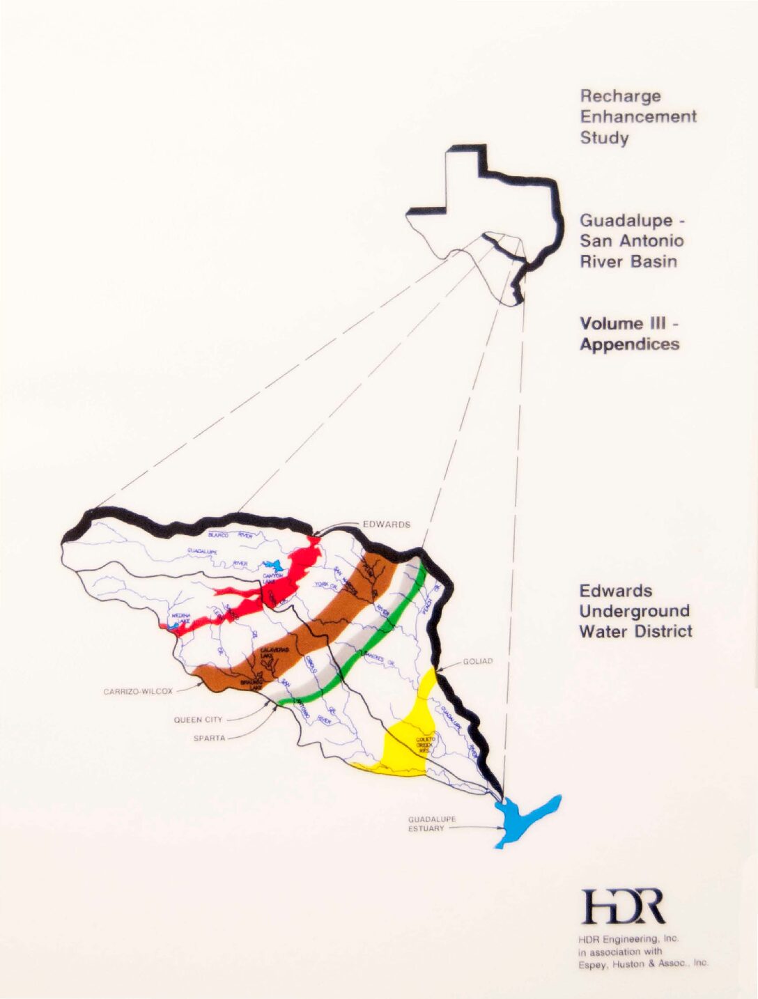
Description: Appendices to Recharge Enhancement Study Guadalupe-San Antonio River Basin. See companion documents.
Location: Guadalupe River Basin, San Antonio River Basin
Summary:Appendices to Recharge Enhancement Study Guadalupe-San Antonio River Basin. See companion documents.
Quantifying Diffuse Recharge at Camp Bullis, TX: Integrating Soil Water, Evapotranspiration, and Remote Sensing
Description: This report summarizes the results of a three-year study centered in Camp Bullis in northern Bexar County that evaluates diffuse recharge into the Edwards and Trinity aquifers using direct ET measurements, remotely sensed data, and Hydrus models to estimate the amount of recharge in the Cibolo Basin.
Location: Camp Bullis, Bexar County, Texas
Pilot Recharge Models of the Nueces and Blanco River Basins
Description: Pilot study to develop HSPF improvement of the MODFLOW study for recharge in the Blanco and Nueces River Basins
Location: Nueces River Basin, Blanco River Basin
Summary:Note: This study has been updated in the document HSPF Recharge Models for the San Antonio Segment of the Balcones Fault Zone of the Edwards Aquifer.
The purpose of this study was to evaluate a new method for computing recharge to the Edwards Aquifer. The computer program Hydrologic Simulation Program Fortran (HSPF) was evaluated using input datasets for the Blanco and Nueces River basins. The HSPF methodology was determined to be a significant improvement over historically utilized methods and will be applied to all basins that recharge the aquifer. The pilot study was completed in June 2002 by HDR Engineering, Inc., Austin, Texas.
Pilot Edwards Aquifer recharge calculation models of the Nueces and Blanco River (Recharge) Basins have been completed in the Hydrologic Simulation Program Fortran (HSPF). In a manner consistent with Edwards Aquifer Authority (EAA) objectives, the pilot recharge models retain the strengths and overcome the weaknesses of traditional recharge calculation methods while providing versatile tools sufficiently accurate for both regulatory and research purposes. Specific advantages of these models over traditional methods include the following:
(1) Use of a water balance approach integrating many relevant hydrologic parameters including measured streamflow, precipitation, evaporation, and diversions as well as soil type, antecedent moisture conditions, land use, and interception/infiltration/evapo-transpiration characteristics.
(2) Computation of recharge on a daily, rather than monthly, timestep through direct simulation of watershed response to daily precipitation and streamflow inputs.
(3) Provision for geographical distribution of recharge into specified land segments and river reaches on the outcrop of the Edwards Aquifer.
( 4) Ability to quantify effects of changes in watershed characteristics (dam construction, brush management, land development) and/or climatological influences (weather modification) on aquifer recharge.
(5) Limited capability to approximate inter-formational transfer of groundwater from the Edwards Plateau and Trinity Aquifers that contributes to Edwards Aquifer recharge.
Application of the pilot recharge model of the Nueces River (Recharge) Basin for the 1950 through 1998 historical simulation period results in the annual recharge estimates shown in Figure ES-11 and a long-term average recharge of 117,280 acft/yr. Similarly, application of the pilot recharge model of the Blanco River (Recharge) Basin for the 1956 through 1998 historical simulation period results in the annual recharge estimates shown in Figure ES-12 and a long-term average recharge of 74,491 acft/yr. For comparable historical periods ending in 1996, Figure ES-13 compares long-term average recharge rates from the pilot recharge models to those based on traditional HDR and USGS methods. It is apparent in Figure ES-13 that Edwards Aquifer recharge derived by application of the pilot recharge models more closely approximates traditional USGS estimates in the Nueces Recharge Basin and traditional HDR estimates in the Blanco Recharge Basin.
HSPF Recharge Models for the San Antonio Segment of the Balcones Fault Zone of the Edwards Aquifer Part 1
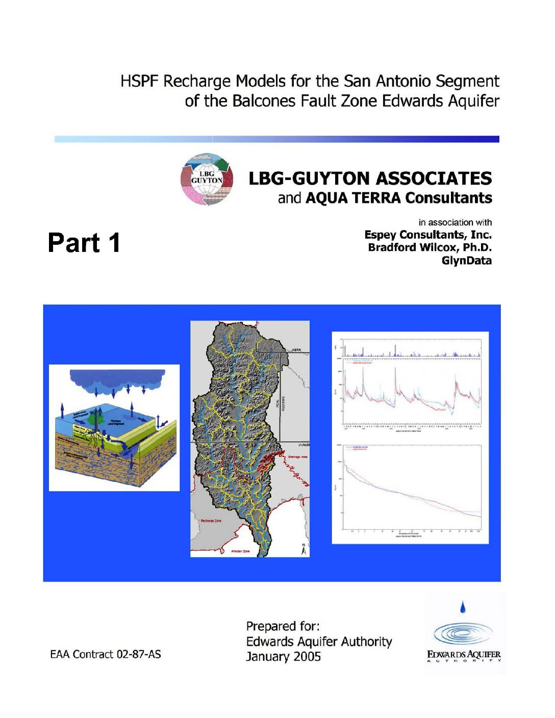
Description: Development of complete contributing and recharge zones for the HSPF enhancement to MODFLOW from historical data on all nine drainage basins of the Edwards Aquifer Balcones Fault Zone San Antonio Segment
Report Number: 02-87-AS
Location: Edwards Aquifer, Balcones Fault Zone, San Antonio Segment, Contributing Zone, Recharge Zone
Summary:Note: This document is Part 1 of 3 parts.
The purpose of this study was to develop a new method for estimating recharge to the Edwards Aquifer. The computer program Hydrologic Simulation Program Fortran (HSPF) was used to develop a comprehensive recharge estimation model for the region. A previously completed pilot study project modeled portions of two of the nine basins applicable to the Edwards Aquifer. The pilot study indicated HSPF as a viable tool for recharge estimation and led to the initiation of this project. This project developed recharge models for all nine basins relevant to the Edwards Aquifer, by modeling the upstream (drainage) area, as well as the recharge zone of the aquifer. The project was completed in March 2005 by LBG Guyton Associates, Inc., Austin, Texas.
[From the Executive Summary]
Hydrologic models have been developed for the nine basins that recharge the San Antonio section of the Edwards Aquifer and recharge estimates from these models have been implemented into recharge data for the Edwards Aquifer MODFLOW model. The models have been calibrated for the basins of the (1) Nueces/West Nueces Rivers, (2) Frio/Dry Frio Rivers, (3) Sabinal River, (4) area between Sabinal and Medina River (Seco and Hondo Creeks), (5) Medina River, (6) area between Medina and Cibolo (San Geronimo, Helotes, and Salado Creeks), (7) Cibolo/Dry Comal Creeks, (8) Guadalupe River, and (9) Blanco River.
The main objective of the project was to develop hydrologic simulation models for the entire contributing and recharge zone of the Edwards Aquifer with the main focus being to estimate historical recharge to the Edwards Aquifer from 1950 through 2000. In addition to estimating
recharge, secondary objectives of the project were to ensure that the models were compatible with the future goals of assessing issues important to the Authority and other stakeholders, including water quality, land use changes, weather modification, brush control, recharge dams, and flood control. To achieve these goals, the entire contributing zone (above the Edwards aquifer recharge zone) of each of the nine basins was incorporated into the models.
The HSPF models are valuable tools for simulating the hydrology of the nine basins and assessing recharge under various hydrologic conditions. The models provide a new tool for assessing hourly hydrology, which could not be done with the traditional methods. They simulate each basin more discretely than the traditional methods do; which makes the models more appropriate for evaluating recharge enhancement, water quality and many other technical and regulatory issues.
To improve the accuracy of the models, more detailed field studies should be completed in selected areas of the recharge zone. These assessments should include field-scale rainfall-runoff and evaporation studies, tracer studies, channel loss studies, and other evaluations. Suggested model improvements include incorporating more detailed precipitation data from Authority rain gages that has been collected since this study was initiated; estimating model parameters by developing models for smaller watersheds; and enhancing the existing models to simulate water quality.
Enhanced Characterization and Representation of Flow through Karst Aquifers-Phase II Revision 1
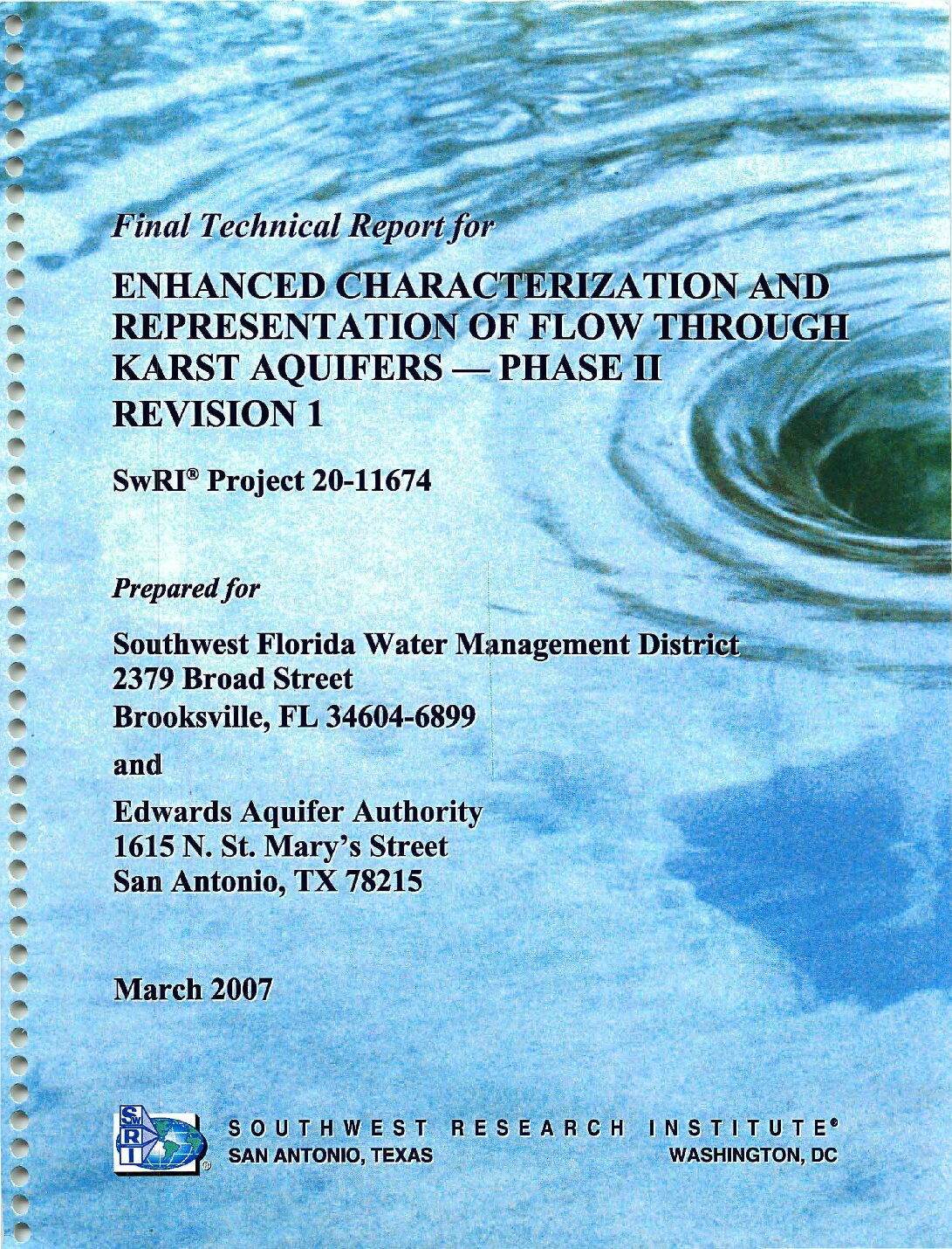
Description: Development and testing of the MODFLOW DCM version 2.0 model for karst aquifers
Report Number: SwRI Project 20-11674
Location: Edwards Aquifer, Balcones Fault Zone, Barton Springs Segment; Floridan Aquifer, Santa Fe River Sink/Rise system
Summary:In 2003, Southwest Research Institute® (SwRI) initiated a long-term project to develop new modeling approaches and tools to address applications involving karst aquifers with significant conduit flow. Phase I of the project identified key considerations for modeling karst aquifers, evaluated existing modeling approaches, and selected an approach for detailed investigation and development. To meet the modeling needs, DCM Version 1.0, a dual-conductivity model for MODFLOW, was developed. The first application using DCM enhanced an existing MODFLOW model for the Barton Springs segment of the Edwards Aquifer. Reasonable replication of the conduit/matrix flow system was achieved in terms of matching hydraulic heads and spring discharge.
Phase II of the karst modeling project was commissioned by the Edwards Aquifer Authority and the Southwest Florida Water Management District and initiated in mid-2005. The objective of Phase II was to enhance the karst modeling approach that was developed during Phase I and assess the capability and limitations of DCM by applying it to two karst aquifers that exhibit contrasting hydrogeologic characteristics: the Barton Springs segment of the Edwards Aquifer in south-central Texas and the Santa Fe River Sink/Rise system of the Floridan Aquifer in north-central Florida.
A new solver capable of solving the highly nonlinear systems associated with the conduit/matrix flow regime under confined/unconfined conditions was developed.. Because of this new data requirement, the resulting dual-conductivity model could not be implemented as a self-contained package, and it was necessary to modify multiple packages. Therefore, a new MODFLOW variant, MODFLOW-DCM Version 2.0, was created. ..
The Barton Springs model was completely revised in Phase II by incorporating site-specific groundwater hydraulic data and more detailed conduit characterization information. The model was successfully calibrated to hydraulic head and spring flows for steady and transient conditions. Sensitivities to major parameters were identified. MODFLOW-DCM successfully simulated the drying and rewetting of cells in the unconfined recharge zone of the Barton Springs model.. Sensitivity analysis indicated that the addition of the turbulence model resulted in an improved match to the dynamic spring hydrograph for Barton Springs and that the matrix/conduit exchange parameter can be tuned to allow for a better match of dynamic spring flow.
Model results also highlighted the sensitivity of spring discharge to conduit elevation relative to matrix elevation. This important outcome confirms that conduit elevations influence flow during low-flow conditions because some conduits can become dewatered when water levels are sufficiently lowered. This feature enables the conduit elevations to be determined by model calibration during low-flow periods.
MODFLOW-DCM was applied to the Santa Fe River Sink/Rise system in the Floridan Aquifer to test the ability of MODFLOW-DCM to simulate large flow karst systems with relatively high matrix permeability. Although the Santa Fe River Sink/Rise system was selected because there is extensive data on site characterization, it was necessary to develop a new MODFLOW model because the scale and resolution of existing models were inappropriate to test the ability of MODFLOW-DCM to match the dynamic hydraulics of the Santa Fe River Sink/Rise system.
The Floridan Aquifer model reasonably captured the basic hydraulic dynamics of the Santa Fe River Sink/Rise system in terms of water elevations at the River Sink and River Rise, discharge at the River Rise, and hydraulic head values at four calibration wells.
The MODFLOW-DCM variant is completed and promises to provide significant improvements in modeling groundwater flow through conduits located within porous media. Interest has shifted from model development to model calibration and parameter estimation. Development of advanced calibration and parameter estimation tools and techniques will allow for quicker and better focused karst aquifer characterization.
Edwards Aquifer Authority Synoptic Water Level Program 1999-2004 Report
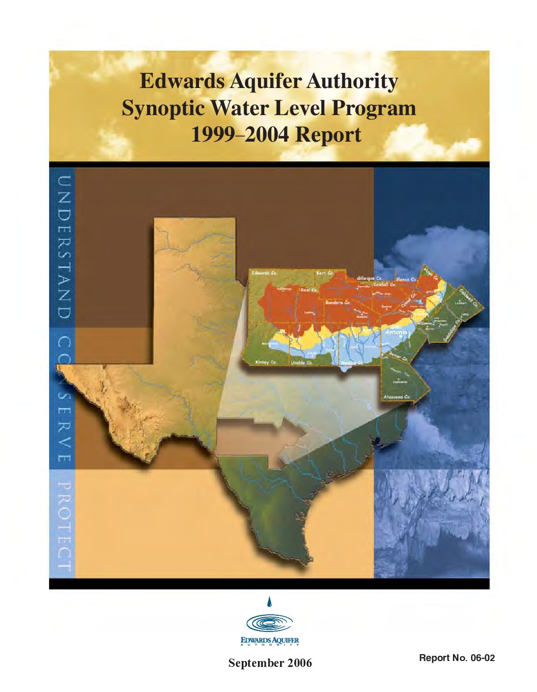
Description: 1999-2004 synoptic water level study
Report Number: 2-Jun
Location: Edwards Aquifer, Balcones Fault Zone, San Antonio Segment
Summary:The Edwards Aquifer Optimization Program was created to better manage the Edwards Aquifer by furthering the understanding of the aquifer and the natural systems it supports. The goal of the Synoptic Water Level Study is to contrast the water level changes during low to high demand periods. By measuring wells in each county, the Authority is able to obtain an aquifer-wide snapshot' to determine aquifer groundwater level and flow conditions. The data for the period 1999-2004 are summarized in the report. The report includes a summary of the findings through 2004, as well as water level contour maps, and tables of all water level measurements collected.
This research project is being conducted in cooperation with the San Antonio Water System, Texas Water Development Board, and U.S. Geological Survey.
[From Recommendations and Conclusions]
[T]he synoptic data reported herein effectively summarize the shape of the water surface in the Edwards Aquifer on a regional scale for a range of aquifer water levels. This summary was accomplished by collection, validation, and analysis of the 16 synoptic data sets included herein. The study also indicates that localized variations exist in the aquifer's flow regime, with the most prominent variations apparently occurring between recharge and artesian zones. The study has also confirmed the need to collect focused synoptic data in order for more insight to be gained with regard to flowpaths within the aquifer. The variations detected in the recharge zone of Bexar County confirm the efficacy of additional data points (see Figure 5).
This study has also effectively identified areas in need of more detailed investigation, such as the Knippa Gap, Cibolo Creek area, Hays County groundwater divide, and the interface between the Trinity and Edwards aquifers, as well as the recharge and artesian zone boundary within the Edwards Aquifer.
Collection of regional and focused synoptic data will help to improve the general understanding of the system and the flowpaths that exist within it.


