 Conditions
Science & Data Document Library
Science and Data Resources
Records of Precipitation, Aquifer Head, and Ground-Water Recharge to the Edwards and Associated Limestones, San Antonio Area, Texas, 1965
Description: Annual report for 1965 on precipitation, aquifer levels, and recharge to the Edwards Aquifer issued by the Edwards Underground Water District
Report Number: Bulletin 12
Location: Edwards Aquifer Balcones Fault Zone San Antonio Segment
Summary:The Edwards and associated limestones, the principal aquifer in the San Antonio area, has been the subject of numerous geologic and hydrologic reports. Records of precipitation, water levels, and estimates of recharge to the aquifer during 1965 are summarized in this report, which is one of three basic-data reports published yearly by the Edwards Underground Water District. The gathering of these records (and data) is part of the continuing hydrologic investigation by the U. S. Geological Survey in cooperation with the Edwards Underground Water District, the Texas Water Development Board, and the city of San Antonio.
Table 1 shows the annual precipitation at selected stations throughout the San Antonio area for 1965 and the annual average for each of these stations. Rainfall was slightly above average in the western part of the area to moderately heavy in the eastern part of the area.
The recorded high and low water levels during 1965 in five selected key wells are shown in table 2. In 1965, the water levels fluctuated above the midpoint between the record high and low levels which are also shown in table 2. Because of the above-average rainfall in 1965, the aquifer head in the eastern part of the aquifer increased to levels generally higher than those of 1962 and 1963 (Garza, 1963, p. 4; Garza, 1964, p. 3).
Recharge to the Edwards and associated limestones is chiefly from streams that lose most of their base flow and a part of their flood flow as they cross the Balcones fault zone on the outcrop of the aquifer. The recharge is estimated from records of continuous discharge at gaging stations located above and below the infiltration areas in each of most of the streams . The monthly mean discharges at the gaging stations during October-December 1965 are shown in table 3. Streamflow records for January-September 1965 have been published by the U.S. Geological Survey (U. S. Department of the Interior, Geological Survey, Water Resources Division, 1965).
Table 4 shows the recharge in each basin of the San Antonio area for 1965 and the average annual recharge for the period 1934-64. The recharge estimates for 1934- 64 were taken from an open-file report (to be published by the Texas Water Development Board) on the 1960- 64 studies of the Edwards and associated limestones by Sergio Garza. The basic methods employed by Petitt and George (1956) and by Garza (1962; open- file report) were used for estimating the 1965 recharge, which was well above the annual average. During 1965, the basin areas of Cibolo and Dry Comal Creeks received over 18 percent of the total recharge, and nearly 38 percent of this total took place during the May-June floods.
Valdina Farms Sinkhole: Hydrogeologic & Biologic Evaluation

Fauna of Wells Near the Saline Water line of the Edwards Aquifer, Texas
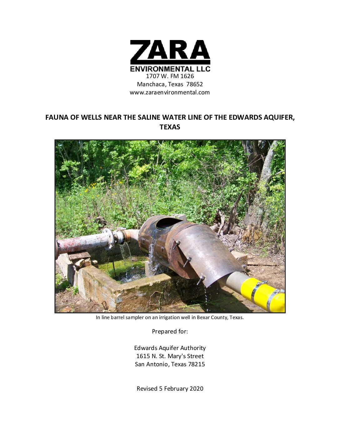
Description: Zara Deep Aquifer Biota Study of Fauna of Wells Near the Saline Water line of the Edwards Aquifer
Location: Edwards Aquifer, Balcones Fault Zone, San Antonio Segment, Uvalde County, Medina County, Bexar County, Comal County, Hays County
Summary:The Edwards Aquifer Authority contracted with Zara Environmental LLC, to perform a three-year study to document the current status and distribution of organisms in the artesian portion of the Edwards Aquifer. This is the second major sampling effort in the artesian portion of the aquifer and the first one completed in more than 30 years.
This report documents the findings of the study. Twelve sites ranging from 111 to 652 meters in depth yielded invertebrate fauna, including 22 unique taxa in eight orders. In addition, three new localities for the toothless blindcat were found. One represented a six kilometer range extension to the southwest.
Effects of Brush Management on the Hydrologic Budget and Water Quality In and Adjacent to Honey Creek State Natural Area, Comal County, Texas, 2001-10
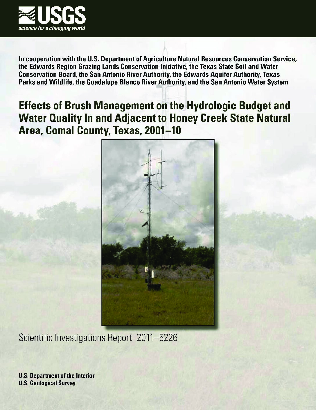
Description: Effects of brush management on hydrologic budget and water quality. May not be generalizable to all locations. See Fact Sheet companion document of the same name.
Report Number: USGS SIR 2011-5226
Location: Comal County, Honey Creek State Natural Area
Summary:Note: May not be generalizable to all locations. See Fact Sheet companion document of the same name.
The U.S. Geological Survey, in cooperation with the U.S. Department of Agriculture Natural Resources Conservation Service, the Edwards Region Grazing Lands Conservation Initiative, the Texas State Soil and Water Conservation Board, the San Antonio River Authority, the Edwards Aquifer Authority, Texas Parks and Wildlife, the Guadalupe Blanco River Authority, and the San Antonio Water System, evaluated the hydrologic effects of ashe juniper (Juniperus ashei) removal as a brush management conservation practice in and adjacent to the Honey Creek State Natural Area in Comal County, Tex.
By removing the ashe juniper and allowing native grasses to reestablish in the area as a brush management conservation practice, the hydrology in the watershed might change. Using a simplified mass balance approach of the hydrologic cycle, the incoming rainfall was distributed to surface water runoff, evapotranspiration, or groundwater recharge. After hydrologic data were collected in adjacent watersheds for 3 years, brush management occurred on the treatment watershed while the reference watershed was left in its original condition. Hydrologic data were collected for another 6 years. Hydrologic data include rainfall, streamflow, evapotranspiration, and water quality. Groundwater recharge was not directly measured but potential groundwater recharge was calculated using a simplified mass balance approach. The resulting hydrologic datasets were examined for differences between the watersheds and between pre- and post-treatment periods to assess the effects of brush management. The streamflow to rainfall relation (expressed as event unit runoff to event rainfall relation) did not change between the watersheds during pre- and posttreatment periods. The daily evapotranspiration rates at the reference watershed and treatment watershed sites exhibited a seasonal cycle during the pre- and post-treatment periods, with intra- and interannual variability. Statistical analyses indicate the mean difference in daily evapotranspiration rates between the two watershed sites is greater during the post-treatment than the pre-treatment period. Average annual rainfall, streamflow, evapotranspiration, and potential groundwater-recharge conditions were incorporated into a single hydrologic budget (expressed as a percentage of the average annual rainfall) applied to each watershed before and after treatment to evaluate the effects of brush management. During the posttreatment period, the percent average annual unit runoff in the reference watershed was similar to that in the treatment watershed, however, the difference in percentages of average annual evapotranspiration and potential groundwater recharge were more appreciable between the reference and treatment watersheds than during the pre-treatment period. Using graphical comparisons, no notable differences in major ion or nutrient concentrations were found between samples collected at the reference watershed (site 1C) and treatment watershed (site 2C) during pre- and post-treatment periods. Suspended sediment loads were calculated from samples collected at sites 1C and 2T. The relation between suspended sediment loads and streamflow calculated from samples collected from sites 1C and 2T did not exhibit a statistically significant difference during the pre-treatment period, whereas during the post-treatment period, relation between suspended-sediment loads and streamflow did exhibit a statistically significant difference. The suspended sediment load to streamflow relations indicate that for the same streamflow, the suspended sediment loads calculated from site 2T were generally less than suspended-sediment loads calculated from site 1C during the post-treatment period.
Threatened and endangered plant and animal species of the Edwards Aquifer
Description: Description, distribution, habitat, feeding and breeding requirements of seven species of the Edwards Aquifer listed by the United States Fish & Wildlife Service and/or Texas Parks and Wildlife Department as Threatened or Endangered as of 1995. Note: this document is included for its historical value and may have been superseded by more recent classifications and publications.
Location: Edwards Aquifer
Summary:Description, distribution, habitat, feeding and breeding requirements of seven species of the Edwards Aquifer listed by the United States Fish & Wildlife Service and/or Texas Parks and Wildlife Department as Threatened or Endangered as of 1995. Note: this document is included for its historical value and may have been superseded by more recent classifications and publications.
Aquatic Vegetation Laboratory Study: Phase 1: Observations of water quality changes and plant growth under various flows. Phase 2: Effects of carbon dioxide level on aquatic plants found in the Comal and San Marcos Springs/River Ecosystems. Final Report Variable Flow Study: Project 802, Task 27 San Marcos National Fish Hatchery & Technology Center, San Marcos, Texas
Fountain Darter Laboratory Study Reproductive Response to Parasites and Temperature Fluctuations

Description: Laboratory study of effects of temperature fluctuations and parasites on reproduction in the fountain darter
Report Number: Southwest Texas State University Variable Flow Study: Project 802, Task 18
Location: Comal River, San Marcos River [Laboratory]
Summary:[from the Executive Summary]
The following study was conducted by Dr. Timothy Bonner (Southwest Texas State University) to examine with a controlled laboratory experiment the effect of fluctuating temperatures and cercariae (parasite) infestation on total egg, healthy egg, and larval production. Temperatures included a constant 24°C, fluctuating 24 to 26°C, fluctuating 26 to 28°C, and fluctuating 28 to 30°C; all fluctuations were on a 12h day, 12h night cycle. These temperatures were chosen because the lowest level falls within the range of temperatures commonly found in fountain darter habitats. The next two treatments had temperatures that may potentially be reached during low-flow/high temperature periods (~26°C); the last treatment included a range above the worst-case scenario to evaluate the potential improvement with the 2°C diel fluctuation. Dr. Bonner's report detailing his methods and results is attached.
The first analysis revealed that parasites did not have an effect on egg or larval production, so darters with and without parasites were lumped for all other analyses. This is an important finding of the study. Parasites are a concern in the Comal Springs ecosystem because of high rates of infestation, particularly in areas where the fountain darters are most abundant (old channel). Parasites do not appear to cause mortality directly in the wild (T. Brandt, USFWS, personal communication) but have been assumed to have sub-lethal effects (cause greater stress, reduce predator avoidance, reduce reproductive ability). These results suggest that, at least in the early stages of infestation, there is little effect on reproductive capability. It is possible; however, that long-term infestation or greater parasite loads may have negative effects that were not observed here.
There were significant differences observed between temperature treatments in the number of healthy eggs and larvae produced; the 24°C treatment resulted in significantly more eggs overall, healthy eggs and larvae than any other trial. This is not surprising since this temperature is within the range of mean temperatures found in areas where fountain darters are abundant. The two treatments with increasingly higher temperatures (24-26°C and 26-28°C) had similar numbers (not significantly different) of total eggs and healthy eggs produced, but the number of larvae produced was lower in the 26-28°C treatment. The 28-30°C treatment resulted in virtually zero eggs produced. Although standardizing healthy eggs and larvae produced by percentage of total eggs produced did reveal less significant differences between treatments, the large decline in total egg production between treatments suggests that temperatures in the ranges tested here do have an important effect on reproduction in darters.
Overall, these results do not confirm our initial hypothesis. It appears that, in the laboratory, egg and larval production do not benefit greatly from the 2°C diel fluctuation that fountain darters experience in the wild. As in previous studies, lower egg and larval production was observed at temperatures higher than in controls (23°C and 24°C). Regardless of findings in the laboratory, the results do not necessarily translate directly into conditions occurring in the wild. Other unknown factors may also affect fountain darter health and reproductive capability in the laboratory with increasing temperatures differently than conditions experienced in the wild. Therefore, laboratory results and available field data should be considered jointly to evaluate temperature effects on fountain darter reproduction.
Technical Assessments in Support of the Edwards Aquifer Science Committee J Charge: Flow Regime Evaluation for the Comal and San Marcos River Systems
Description: Modeling for critical flow requirements to protect endangered species in the Comal and San Marcos Rivers
Location: Comal River, San Marcos River
Summary:This report summarizes the technical analysis of the flow dependent characteristics of physical habitat for target aquatic species within the Comal and San Marcos Rivers to support the Science Committee of the Edwards Aquifer Recovery Implementation Program in development of their recommendations for flow regimes under Senate Bill 2 J Charges'. Target species were fountain darter (Etheostoma fonticola), Texas wild rice (Zizania texana), and the Comal Springs riffle beetle (Heterelmis comalensis). In addition, qualitative assessments of other native and non-native species as well as recreation were considered.
A team of private, state, federal, and university researchers knowledgeable with the target species and in particular, the Comal and San Marcos River systems were used to develop influence diagrams for the three target species to aid the evaluation of both intrinsic and extrinsic factors that affect the persistence of these target species. The team also used these diagrams to evaluate existing data and specific modeling approaches to aid in their evaluations of flow regimes for each river system. As part of this process, the team considered other factors such as non-native species of plants and animals, parasites, recreation, and anthropogenic impacts due to watershed development.
Historical research and existing physical, chemical, and biological monitoring data collected through 2009 from both the Comal and San Marcos Rivers were integrated to develop biological response functions for factors such as depth, velocity, substrate/vegetation use, water temperatures, etc. Habitat suitability curves were reviewed for fountain darters, Texas wild rice, and Comal Springs riffle beetles based on new data collected over the past eight years. Existing monitoring data were used to update the fountain darter habitat suitability curves for depth and velocity. No modifications were made to the Texas wild rice habitat suitability curves and as noted below, simulations of available habitat for the Comal Springs riffle beetle relied on a simplified surface area analysis as well as an alternative analysis based on data collected during the original Comal River studies. Vegetation maps relied upon those derived from the original studies conducted in the Comal and San Marcos due to lack of system-wide revised vegetation mapping data being available. These existing or revised habitat suitability curves for the target species, in conjunction with the two-dimensional hydrodynamic models for each river and associated one-dimensional water quality/temperature models for the Comal and San Marcos Rivers were used to predict the location and quality of wild rice, fountain darter, and riffle beetle habitat as a function of different flow ranges in each river system. No new water quality modeling was undertaken and the report relied upon the previous modeling results for both river systems. Model sensitivity to changes in channel topographies and habitat suitability curves for depth and velocity for fountain darters were also explored.
Updated modeling results show that the largest difference in the habitat versus flow relationships for fountain darters were attributed to differences in habitat suitability curves. Modeling of fountain darter habitat for pre versus post 1998 flood induced channel changes in the San Marcos River primarily resulted in a scaling of the magnitude of predicted available habitat rather than a substantive change in the functional relationship. In both the San Marcos and Comal River systems, potentially adverse thermal conditions may begin to limit darter larval survival under very low flow conditions.
Modeling results for Texas wild rice in the San Marcos River suggest that habitat availability begins to decline below about 65 cfs with increasing risk to physical disturbance and drying, especially at and below 30 cfs. The modeling results also suggest that protection of Texas wild rice would likely ensure protection for the other target species such as fountain darters.
Modeling results for the Comal Springs riffle beetle based on total surface area in the main spring runs (i.e, 1,2, and3) were somewhat insensitive to modeled total Comal flow rates as low as 30 cfs. However, maintaining spring run flows provides the most conservative strategy as it provides the best overall protection for the other flow dependent aquatic resources such as fountain darters and other native species.
Based on modeling results and analysis, recommendations are made for future work in light of the on-going data collection and modeling in support of the Edward Aquifer Habitat Conservation Plan.
Although this report provides the technical documentation on modeling approaches and summary results, no specific flow recommendations are made. The Science Committee of the Edwards Aquifer Recovery Implementation Program will recommend target flow regimes for each river system.
Comal Springs Riffle Beetle Laboratory Study Evaluation Under Variable Flow Conditions
Description: Laboratory study of the Comal Springs Riffle beetle under varying horizontal and vertical flow conditions
Report Number: San Marcos National Fish Hatchery & Technology Center Project 802, Task 18
Location: Comal Springs (Laboratory)
Summary:[from the Executive Summary]
BIO-WEST conducted laboratory experiments to evaluate the habitat use of the endangered Comal Springs riffle beetle, Heterelmis comalensis. A paucity of data regarding physiological and ecological needs of the insect limits ones understanding of its habitat and necessitates basic research of the species. This study expanded upon recent field efforts by BIO-WEST, which revealed an
expansion of the known range of the Comal Springs riffle beetle. Previously it had been found primarily in spring runs feeding Landa Lake, New Braunfels, Texas, but individuals have recently been collected in seeps along the shoreline and around upwellings on the bottom of this lake.
Because the Comal Springs riffle beetle is found outside of the spring runs, it may be able to occupy more habitat than previously believed; this may also help explain the persistence of the species during periods of drought, particularly in 1956 when Comal Springs ceased flowing for 5-months. Nevertheless, the tendency of the species to congregate in areas of spring upwelling raises questions about how individuals react to a significant reduction or cessation of flow. It has been suggested that individuals retreat into springheads during such periods of low-flow. Under these conditions, water movement will attenuate and springflow may only be detected in subterranean habitats. It is also possible that a portion of the population regularly occupies interstitial spaces below the uppermost layer of gravel and rock that has been sampled exclusively to date.
To examine this issue, an experimental representation of the natural habitat was designed and the response of the Comal Springs riffle beetle to water flow of varying intensities and with different
combinations of horizontal and vertical flow assessed. Observations were made of depth and orientation toward current under the different treatments applied with these variables. Barriers to restrict vertical movement and flow were added in the later trials. Initial trials were conducted with a surrogate species, Microcylloepus pusillus, to evaluate the design of the enclosures and assess several artificial substrates.
Although results revealed no statistically significant conclusions, the beetles displayed tendencies for movement downward and towards current. All trials with the surrogate and the first two trials with the Comal Springs riffle beetle had similar results; the beetles all congregated on or near the bottom regardless of conditions. To account for a potential oversimplification of the natural habitat
(very large interstitial spaces), barriers were placed between every other layer. The barriers were installed to restrict downward movement and simulate the increasingly small spaces likely to be
encountered below the upper layer of substrate in the wild. The barriers may have also improved lateral flow across layers such that beetles were more able to detect flow direction more readily; more beetles were found in the front of each panel, where flow originated. The results of different barrier/flow intensity/flow direction combinations were for beetles to be found in the higher layers
with horizontal flow only across the top layers, to display a more even vertical distribution when horizontal flow was allowed throughout, and to congregate on the bottom in upwelling-only
treatments.
The tendency of the Comal Springs riffle beetles to orient toward flow confirms field observations that the species associates with flowing water. The overwhelming tendency for the beetles to move downward during the first two trials was hardly conclusive, but trials with highly restrictive barriers (i.e., 1-5% passable) provide evidence to suggest that individuals will search for moving water when it cannot be detected near the surface. With the barriers, upwelling flow would have been severely restricted and likely detected only by individuals once they had moved to the lower levels, yet most beetles were found there. In contrast, trials with only lateral flow across the upper layers had more beetles in those layers; the beetles presumably did not move to lower layers in search of the requisite flow. Finally, a trial with flow decreasing to zero over time and barriers in place resulted in a higher frequency of beetles in the lower layers in the trial with horizontal flow throughout. If these observations translate to behavior in the natural habitat, it is likely that individuals would respond to decreasing flow by retreating into more subterranean habitats. Further, it is possible that individuals may inhabit areas deeper in the gravel and sediment around spring orifices than have been previously sampled.
It is important to note that these results may be affected by a number of factors that remain unknown about the species and were unaccounted for in this experiment. Dietary needs, reproductive behavior, etc., also may have influenced movement. In the natural habitat, niche division (intra- or interspecific competition) and predator avoidance may also largely determine habitat selection. Very little is known about this insect and more research is necessary to discern how it would behave under different flow conditions in its natural habitat.
Exploring Drought in the San Antonio Area Between 1700 and 1979
Description: Using tree rings to analyze droughts for the San Antonio area between 1700 and 1979
Report Number: Special Report No. 29
Location: San Antonio Area
Summary:Relying on tree-ring derived estimates of the summer Palmer Drought Severity Index (PDSI) presented by Cook et al. (1999), this document investigates drought frequency, intensity, and duration in the San Antonio area for a 280-year period between A.D. 1700 and 1979. The PDSI is a widely used index that is based on several variables and is designed to monitor soil moisture conditions. In most circumstances, the PDSI varies between 4.0 and -4.0, with an average year falling between 0.5 and -0.5. Here, I define drought as a value of -1.0 or less on the tree-ring derived PDSI. Using this definition, there were 40 droughts reflected in this 280-year stretch, with the average drought lasting 1.8 years. Long-term droughts, defined as droughts exceeding three years in duration, occurred four times in the available data, with three of these four being in the 1700s, and the fourth occurring in the early 1950s. This 1950s drought, covering a six-year period, was both the longest drought reflected in the available records as well as the most intensive of the four long-term droughts.
Optimization Technical Studies in Support of the Edwards Aquifer Optimization Program
Description: Summary of proposed optimization studies for the EAA. Note: Is outdated. Has been replaced by more recent modeling studies and water plans.
Location: Edwards Aquifer, Comal Springs, San Marcos Springs
Summary:Summary of proposed optimization studies for the EAA. Note: Is outdated. Has been replaced by more recent modeling studies and water plans.
Trans-Texas Water Program West Central Study Area Phase II Guadalupe-San Antonio River Basin Environmental Criteria Refinement
Description: Modeling, summary of biological studies, and sensitivity analyses to support refinement of environmental criteria for the Trans-Texas Water Program West Central Study Area Phase II Guadalupe-San Antonio River Basin Note: This report is included for its possible historical value but has been replaced by the Texas Water Plan.
Location: Guadalupe-San Antonio River Basin
Summary:- Development and application of water quality models of the Guadalupe and San Antonio Rivers focusing on simulation of dissolved oxygen subject to various effluent loading and streamflow conditions (Section 2);
- Summary and interpretation of pertinent biological studies potentially providing insight into the selection of minimum instream flows (Section 3); and
- Performance of sensitivity analyses illustrating the effects of Zone 2 and 3 triggers and minimum flows on water availability, firm yield with off-channel storage, project cost, instream flows, and freshwater inflows to the Guadalupe Estuary (Section 4)
Note: This report is included for its possible historical value but has been replaced by the Texas Water Plan.
2002_BIOWEST_ComalRiffleBeetle
Well Sampling for Aquifer Biota
Description: Sampling plan for studying subterranean species of the Edwards Aquifer Balcones Fault Zone San Antonio Segment
Location: Edwards Aquifer, Balcones Fault Zone, San Antonio Segment
Summary:The Well Sampling for Aquifer Biota Monitoring Plan was prepared for the Edwards Aquifer Authority by the Edwards Aquifer Research and Data Center at Texas State University and George Veni and Associates in 2001. The monitoring plan addresses the need for new, expanded data and information regarding the subterranean aquifer-dwelling organisms of the San Antonio portion of the Balcones Fault Zone Edwards Aquifer by describing locations and methods for collecting aquifer-dwelling biota similar to the previous sampling in 1979.
[From the Introduction]
The Well Sampling of Aquifer Biota Study (the Study) is one of 17 studies identified in the EAOP [Edwards Aquifer Optimization Program]. It was formulated to address the need for more expanded and updated information regarding subterranean aquifer-dwelling organisms. Thirty-seven species of these organisms have been collected from the portion of the aquifer regulated by the Authority. Thirty-three species are invertebrates, such as amphipods, snails, and flatworms. The amphipods and snails are the most diverse groups of all species collected to date. The invertebrates are widely distributed throughout the aquifer. Four species of subterranean vertebrates have been collected. They include two fish species and two salamander species. They exhibit a much more limited distribution than do the invertebrates. Subsequently, both fish species, the widemouth blindcat (Satan eurystomus) and the toothless blindcat (Trogloglanis pattersonf) are listed as threatened by the Texas Parks and Wildlife Department. The United States Fish and Wildlife Service lists one salamander species, the Texas blind salamander (Eurycea rathbuni), as endangered. No subterranean invertebrate species are listed.
The subterranean aquifer-dwelling organisms have generated substantial interest in the scientific community because of their unique biology, distribution patterns, phylogenetic relationships, and evolutionary history. Limited information about their abundance, distribution, population trends, and other life history information has been developed.
Dr. Glenn Longley, his research associates, and graduate students performed the last comprehensive survey of these organisms in 1979. New information about these organisms will support better-informed decisions regarding aquifer management.
In November 2000, the Authority entered into a contract with Southwest Texas State University (SWTSU) through its Edwards Aquifer Research and Data Center (EARDC).
The contract stipulates that EARDC shall develop a comprehensive Monitoring Plan (the Plan) for sampling locations across the aquifer so as to meet the specific objectives and desires of the Authority, its EAOP, and the HCP. The purpose of this document is to function as the Plan for the Study as funded by the Authority. The Plan provides a simple, concise document that outlines procedures and protocols that will allow researchers to fully implement the Study upon the Authority's review and approval of the Plan. It is understood that, depending upon results and future developments, through time the Plan may be further modified, with approval of the Authority. Modifications may be required to facilitate implementation and completion of the Study and will be documented in required quarterly progress reports and the final report.
Assessment of Instream Flow and Habitat Requirements for Cagle’s Map Turtle (Graptemys caglei)
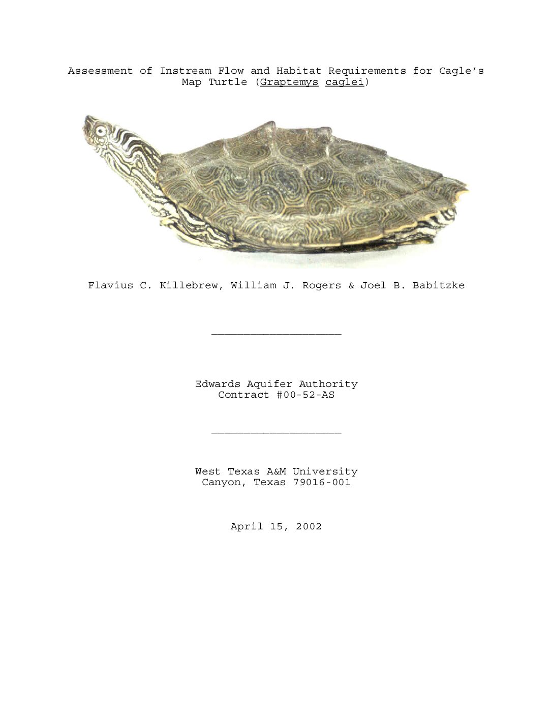
Description: Field study on population and habitat of Cagles Map Turtle and factors affecting them, including instream flow requirements, water quality, and benthics
Location: Guadalupe River
Summary:The purpose of this study was to investigate the instream flow requirements and basic habitat characteristics of the Cagle's Map Turtle in the Guadalupe River system. The study area was from the upper Guadalupe River (near Ingram) to the lower Guadalupe River (near Tivoli ). The turtle's population appears to be steady (declining in one area), based on comparisons of population data from this study with that of other studies. The Cagle's Map Turtle appears to be impacted by physical obstructions in the river more than by varying flow regimes. The study was completed in April 2002 by West Texas A&M University, Canyon, Texas.
[From Introduction]
West Texas A&M University was contracted by the Edwards Aquifer Authority to conduct an assessment of the instream flow and habitat requirements for the Cagle's Map Turtle (Graptemys caglei) in the Guadalupe River. The team was to conduct independent research while working closely with the Project Management Team of the Guadalupe River Instream Flow (GRIF) Study.
The objectives of the study were to:
*Estimate relative abundance of Graptemys caglei.
*Correlate occurrences of Graptemys caglei with detailed physical morphometric maps of stream reaches within the main stream of the Guadalupe River.
*Develop field based habitat association of Graptemys caglei using instream flow methodologies and other techniques.
*Determine instream flow requirements of Graptemys caglei.
*Address water quality parameters and predict attenuation or degradation of water quality in stream segments.
[From Discussion]
Three stream segments were identified that, based on the presence of suitable habitat, lacked predicted populations of Graptemys caglei. In all cases the stream segments lie below either municipal and/or industrial outfalls.
Below Geronimo Creek and the outfall from the City of Sequin a fine precipitate was found on the substrate. Benthic organism density and diversity was reduced in the area. Surber sample results revealed that as the sediments decreased downstream, both benthics and Graptemys caglei populations increased. The traditional water quality parameter list is effective in monitoring nutrient loading and potential for fecal and waste contamination but the list does not address a wide array of inorganic and organic chemicals that could have an effect on the stream ecosystem such as pesticides and herbicides used on lawns and recreational areas.
Additional research is needed to determine why benthic diversity and abundance and Graptemys caglei populations decrease below these areas. Other factors such as disturbance by recreational activities, shooting and periodic habitat disturbance by construction in the streambed and the use of temporary coffer dams should be addressed.


