 Conditions
Science & Data Document Library
Science and Data Resources
Evaluation of the Availability of Additional Water Supplies from the Edwards Aquifer
Description: Decision analysis of eight strategies for their utility in a possible adjustment of the Edwards Aquifer withdrawal cap
Location: Edwards Aquifer, Balcones Fault Zone, San Antonio Segment
Summary:The project team consisting of Daniel B. Stephens & Associates, Inc., Freese and Nichols, Turner, Collie and Braden, and George Veni and Associates has screened 25 studies and 8 strategies through a decision analysis process to identify any study or strategy that could be used to justify an adjustment of the Edwards Aquifer withdrawal cap. At present, two implemented water management strategies, The Edwards Aquifer Authority's (Authority's) Precipitation Enhancement Program and the San Antonio Water System's (SAWS) Aquifer Storage and Recovery (ASR) project, passed the water-budget based screening process. These strategies currently appear to fall somewhat short of meeting some of the objectives required to justify adjusting the withdrawal cap.
The ASR strategy appears to be the more promising of the two. As the SAWS ASR project goes forward, and an operational track record is established, it may well provide the basis for a cap adjustment in the future.
In addition to the SAWS ASR project and the Precipitation Enhancement Program, the project team identified several other studies and strategies that have the potential to support an adjustment to the withdrawal cap once more conclusive information is developed or more reliable performance records are developed.
Draft 30-Year Water Supply Plan
Description: Draft of 30-year water supply plan for 2000-2030 as part of the Authority's Comprehensive Water Management Plan, adapted from the pertinent parts of the South Central Texas Regional Water Plan
Location: Edwards Aquifer Authority Jurisdiction
Summary:The Authority has adopted the recommendations presented in the South Central Texas Regional Water Plan [SCTRWP] as the 30-year water supply plan component of the Authority's Comprehensive Water Management Plan. Relevant information has been extracted from the regional water plan for the portion of the South Central Texas Regional Water Planning Area that is within the Authority's jurisdiction. This includes information pertaining to currently available water supply, projected water demands, projected water supply needs, and recommended strategies and their estimated costs. The Authority has adopted the recommendations presented in the SCTRWP with the understanding that regional water supply planning is a dynamic process and that SCTRWP is to be updated at a minimum every five years. Accordingly, water management strategies recommended for implementation may be modified to reflect changing conditions or new information. Also, it is understood that other water management strategies that are of interest to the Authority will continue to be evaluated for possible inclusion in the SCTRWP and the Authority's water supply plan in the future.
In preparing this plan, the Authority relied on published information contained in the initially prepared draft and final draft of the SCTRWP and its appendices. In addition, extensive coordination occurred with South Central Texas Regional Water Planning Group's engineering and planning contractor to ensure the accuracy of the information presented in the Authority's water supply plan.
The Authority's 30-year water supply plan is organized into three sections. Section 2.0 presents an overview of projected water demand and currently available water supply for the Authority's jurisdictional area. Also presented is a summary of water supply needs derived from the comparison of estimates of currently available water supply with projected water demands. This supply/demand analysis is presented for a baseline scenario of 340,000 acre-feet per year of withdrawals from the Edwards Aquifer, which is the water availability scenario adopted for planning purposes and used in the SCTRWP.
Section 3.0 of this plan provides a summary of water management strategies currently underway and the water management strategies recommended in the SCTRWP for implementation within the Authority's jurisdictional area. This includes information regarding the quantities and timing of water supplies to be provided by each strategy.
Section 4.0 presents a summary of the water supply plan for the Edwards Aquifer Region as presented in the adopted water plan for the South Central Texas Regional Water Planning Area.
Programmatic Assessment: Proposed Rules 31 TAC Chapters 701, 702, 703, 705, 707, 709, 711 Part 1
Description: Part 1 of report on interviews of stakeholders and analysis of how to implement the Edwards Authority Act
Location: EAA geographical jurisdiction
Summary:[from the Executive Summary]
In 1993, the Texas Legislature passed the Edwards Authority Act (the Act), which created the Edwards Aquifer Authority (EAA, or Authority). The Act mandates that the Authority restrict and reduce the withdrawals of groundwater from the Edwards Aquifer, which is the primary water supply for more than 1.5 million Texans in and near San Antonio. The primary aim of the Act is to ensure that the region complies with the federal Endangered Species Act, a law that protects endangered and threatened species that rely on aquifer-fed spring flows for their habitat. The Authority's initial rules will limit permitted withdrawals to 450,000 acre-feet per year (AFY), which is less than needed for existing and future municipal, industrial, and irrigation purposes .
The Authority is in the process of adopting rules to implement the Act. Under Texas law, the Authority must complete several assessments specified in the Government Code. The assessments are intended to help the Authority to choose among policy options and to disclose the effects of the rules to the public. This report is a Programmatic Assessment of the initial rules prepared by the Authority's Rules Assessment Team. The Authority invites the public to review and comment on this document so the Authority's Board of Directors can make decisions based on the best available information.
In making the findings contained in the Programmatic Assessment and reported in this Executive Summary, the Assessment Team interviewed representatives from major stakeholder groups, used quantitative models to estimate certain economic and environmental effects, and evaluated regulatory alternatives.
The principal direct effects of the proposed rules are: (1) to limit withdrawals from the Edwards Aquifer, which will leave many users (especially municipalities) short of water and therefore facing increased costs to acquire replacement supplies; (2) to increase fees paid by users of Edwards water; and (3) to create a marketplace that will function primarily to cause abandonment, retirement, and transfer of irrigation rights.
An Evaluation of the 1997 Edwards Aquifer Irrigation Suspension
Description: Evaluation of Edwards Aquifer Authoritys Irrigation Suspension Program in 1997 and alternatives
Location: Edwards Aquifer Authority Jurisdiction
Summary:In early 1997, the Texas Edwards Aquifer Authority implemented a pilot Irrigation Suspension Program (ISP) with the objectives of increasing springflow and providing relief to municipalities during drought. Irrigators were paid $2,350,000 to suspend water use. The price paid per suspended acre was substantially higher than regional lease rates and land prices would imply. The region experienced a wet spring, but estimates show if conditions had been dry, that suspending irrigation would have substantially reduced pumping and augmented critical springflow. Effects on the local economy appeared to be small. We evaluate the ISP and two alternatives: (1) subsidizing more efficient irrigation technology and (2) buying land. The irrigation suspension is a more cost-effective source of critical water than subsidizing more efficient irrigation because it can be put in place only when water is most needed. But land purchases would reduce program cost if the bid levels remained at the level observed in the 1997 program.
1995_TWDB-etal_AlternativeDiversionsCriteria
The Edwards Underground Reservoir and the Edwards Underground Water District: Uvalde, Medina, Bexar, Comal and Hays Counties
Description: General description of the Edwards Aquifer and the Edwards Underground Water District. Note: No cover page. This document is included for its historical value and has been replaced by more recent ones.
Summary:General description of the Edwards Aquifer and the Edwards Underground Water District. Note: No cover page. This document is included for its historical value and has been replaced by more recent ones.
Evaluation of Stormwater Control Techniques and Programs
Description: Note: This report is included for its historical value and may have been replaced by more recent studies.
Preliminary Draft of Watershed Work Plan for Watershed Protection and Flood Prevention Seco Creek Watershed Medina, Bandera and Uvalde Counties, Texas
Description: Preliminary assessment for methods and costs of flood prevention in the Seco Creek Watershed Note: This report is included for its historical value and may have been replaced by more recent studies.
Location: Seco Creek Watershed, Medina County, Bandera County, Uvalde County
Summary:Seco Creek watershed comprises an area of 268 square miles in Bandera, Medina, and Uvalde Counties. It is estimated that 86.0 percent of the watershed is rangeland, 7.3 percent is cropland, 2.2 percent is pasture and bayland, 2.7 percent is wildlife-recreation land, and 1.8 percent is in miscellaneous uses such as the town of D'Hanis, public roads, railroads, farm and ranch headquarters, and stream channels. There is no Federal land in the watershed.
The principal problem within the watershed is one of frequent and extensive flooding on portions of the 17,098 acres of flood plain which results in damages to crops, grasses, soils, agricultural properties, residential and commercial properties, roads, bridges, and railroad properties. The total floodwater, sediment, erosion, and indirect damages are estimated to average $222,688 annually.
The work plan proposes installing, in a ten-year period, needed land treatment measures and nine floodwater retarding structures. Land treatment measures included are those which contribute directly to watershed protection and reduction of floodwater damages.
Land treatment measures will be operated and maintained by owners and operators of the land upon which the measures will be applied under agreement with the Medina Valley Soil and Water Conservation District and the Nueces-Frio-Sabinal Soil and Water Conservation District. The Commissioners Court will be responsible for operation and maintenance of the floodwater retarding structures. The cost of operation and maintenance for floodwater retarding structures is estimated to be $2,300 annually.
1994 Review and Update of the Position of the Edwards Aquifer Freshwater/Saline-Water Interface from Uvalde to Kyle, Texas-Plates
Description: Large-format plates for 1994 Review and Update of the Position of the Edwards Aquifer Freshwater/Saline-Water Interface from Uvalde to Kyle, Texas. See companion document.
Report Number: 94-05
Location: Edwards Aquifer Balcones Fault Zone San Antonio Segment, Freshwater/Saline Interface, Kyle, Lytle, Medina County, Uvalde
Summary:Large-format plates for 1994 Review and Update of the Position of the Edwards Aquifer Freshwater/Saline-Water Interface from Uvalde to Kyle, Texas. See companion document.
Government Canyon Geologic and Hydrologic Assessment
Description: Government Canyon geologic and hydrologic assessment
Report Number: 93-10
Location: Edwards Aquifer, Balcones Fault Zone, San Antonio Region, Government Canyon
Summary:[From the Introduction]
On March 1, 1993, the Board of Directors of the Edwards Underqround Water District requested that a geologic and hydrologic assessment of the Government Canyon property be performed by District Field Operations staff. This study was requested pursuant to the Board's approval to participate in the purchase of the subject property. The following report is the result of that study.
A literature search and field study were performed to provide a brief overview of the geologic and hydrologic conditions in the Government Canyon area. This area consists of approximately 5152 acres located 3 miles west of Helotes, Texas in northwest Bexar County.
Available literature includes publications from the Texas Water development Board, the Texas Department of Water Resources, and the USGS, as well as an unpublished MS thesis from the University of Texas at Austin. In addition, unpublished data was obtained from HDR Engineering and from various individuals.
Field study methods included reconnaissance to quality check surface geology previously mapped by the USGS, locating wells on the property accessible and suitable for geophysical logging, water quality sampling, and measuring water levels in several wells in the study area.
CONCLUSIONS
The surface and subsurface geologic investigation of the Government Canyon property indicates that recharge to the Glen Rose Aquifer and the Edwards Aquifer occurs in the area. A portion of this recharge moves southwest along the Haby Crossing Fault complex into northeast Medina County. An unknown portion, as seen in water level and water quality data, may flow from the Glen Rose Aquifer across the fault into the Edwards Aquifer.
It is estimated the average annual potential recharge enhancement with a structure on Government creek at the southern Edwards recharge zone boundary would be 600 acre-feet per year. The District has operated the San Geronimo Creek recharge enhancement structure for 13 years in a drainage basin adjacent to the Government Canyon property with similar geology. Average annual recharge at this structure is estimated to be 775 acre-feet, which is similar to the amount of recharge calculated by HDR for Government Creek. Recharge during years of above average rainfall at the San Geronimo dam site contributed approximately 1400, 1100, 1200, 1600 and 2900 acre-feet during 1981, 1985, 1987, 1991 and 1992 respectively.
Since recharge to both the Glen Rose and Edwards aquifers may occur on the property it is imperative that the quality of the surface runoff entering the aquifers be maintained. Additional studies should include aquifer tests and possible tracer studies to determine the flow direction and the presence of communication between the two aquifers. Additional data from remote abandoned wells on the property should be obtained to further define the hydroloqic characteristics of the area.
Using Geophysical Logs in the Edwards Aquifer to Estimate Water Quality Along the Freshwater/Saline-Water Interface (Uvalde to San Antonio, Texas) Plates
Description: Full-size plates from Using Geophysical Logs in the Edwards Aquifer to Estimate Water Quality Along the Freshwater/Saline-Water Interface (Uvalde to San Antonio, Texas). See companion document.
Report Number: 92-03
Location: Edwards Aquifer, Balcones Fault Zone, San Antonio Region, Freshwater/Saline Interface
Summary:Full-size plates from Using Geophysical Logs in the Edwards Aquifer to Estimate Water Quality Along the Freshwater/Saline-Water Interface (Uvalde to San Antonio, Texas). See companion document.
1990 Hydrologic Data Report Compilation of Hydrologic Data for the Edwards Aquifer, San Antonio Area, Texas, 1990, with 1934-90 Summary-Plates
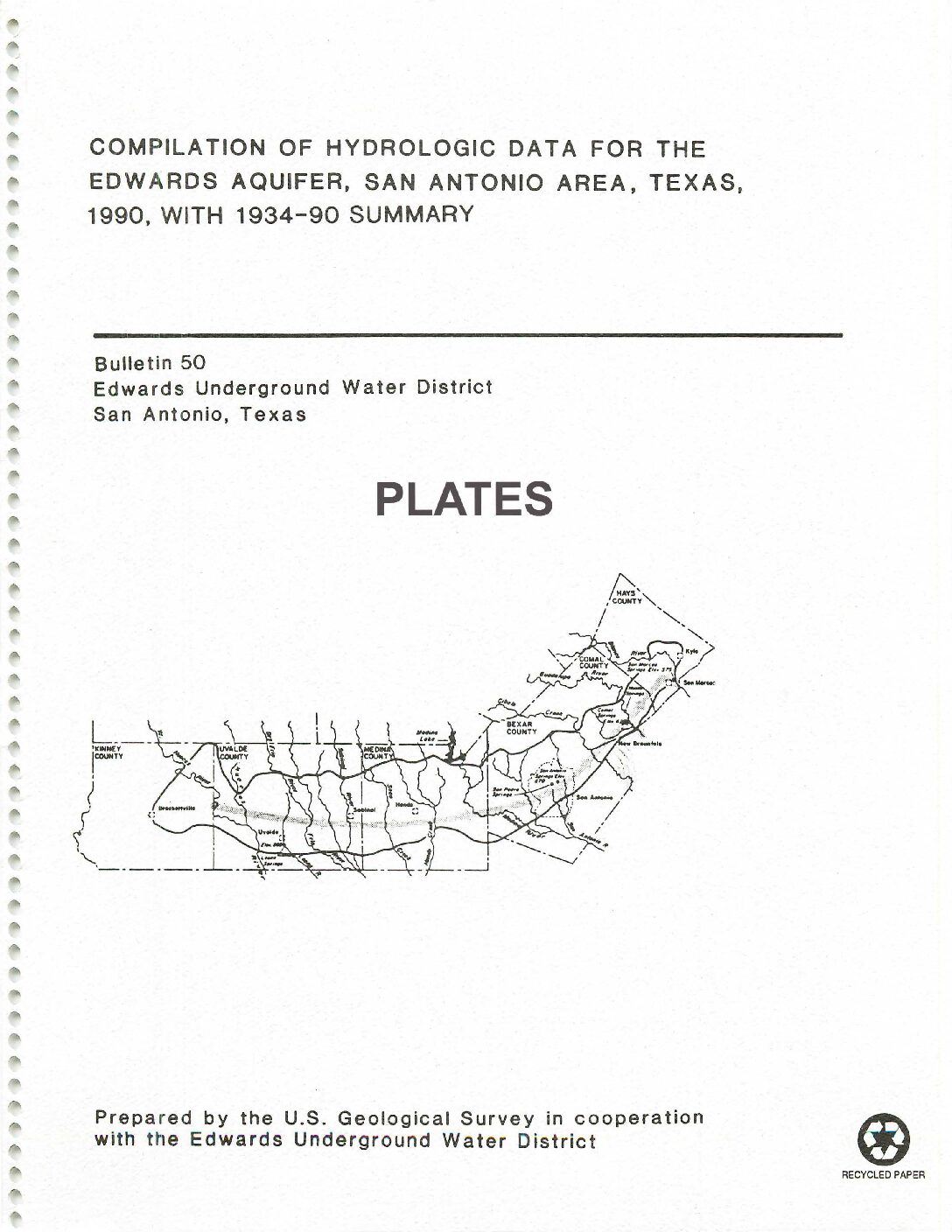
Description: Large-format plates for the 1990 Hydrologic Data Report - see companion document.
Report Number: Bulletin 50
Location: Edwards Aquifer Balcones Fault Zone San Antonio Segment
Summary:Large-format plates for the 1990 Hydrologic Data Report see companion document.
Defining the Edwards Aquifer Freshwater/Saline-Water Interface with Geophysical Logs and Measured Data (San Antonio to Kyle, Texas) Plates
Description: Analysis of geophysical logs to define the freshwater/saline water interface in the Edwards Aquifer between San Antonio and Kyle, TX. Note: These are large-format versions of the plates for the companion document.
Report Number: 93-06
Location: Edwards Aquifer, Balcones Fault Zone, San Antonio Segment, Freshwater/Saline Interface, San Antonio to Kyle, TX
Summary:Large-format plates from analysis of geophysical logs to define the freshwater/saline water interface in the Edwards Aquifer between San Antonio and Kyle, TX. See companion document for small-format plates and text.
Bad Water Line Transect Pumping Test at San Antonio City Water Board’s Artesia Station, March 25, 1987
Description: Pumping test at the San Antonio Artesia Station to determine stability and recovery of wells from stress. Note: Page-size and large-format plates are at the end of the document.
Location: Edwards Aquifer, Balcones Fault Zone, San Antonio Segment, San Antonio, Artesian Zone
Summary:This report discusses the pumping test that was made of wells located at the City Water Board's Artesia Station to stress the Edwards aquifer. Artesia Station is located at the north end of a line of monitor wells that comprise the Edwards Aquifer Bad Water Line Transect in San Antonio.
The pumping test was planned jointly by the City Water Board, U. S. Geological Survey, and William F. Guyton Associates, Inc. It consisted of a 12-hour non-pumping period during which water levels at the various wells were measured to identify water-level trends, a 12-hour period of continuous pumping at a constant rate
from three of the production wells at Artesia Station, and a 6-hour non-pumping period during which water-level recovery measurements were made at the non-pumping wells. In addition, two sets of water samples were collected from each of the pumped wells during the test for chemical analysis by the U.S. Geological Survey. Data from the test were analyzed to determine hydraulic conditions in the aquifer in the vicinity of the Bad Water Line Transect and the impact of this large-scale nearby pumping.
The results from the test show an apparent transmissivity for the Edwards aquifer that is large and in the range from about 6,000,000 to 8,000,000 gallons per day per foot. Because of the way in which hydraulic boundaries affect the results from pumping-test analysis, the actual transmissivity of the Edwards between boundaries is believed to be considerably larger than this.
Drawdowns of water level occurred in both the fresh and saline zones of the aquifer as a result of pumping at a rate of 36 million gallons per day for 12 hours, and ranged from less than 2-1/2 feet at the non-pumped wells at and near Artesia Station to about 1.4 feet at Well J-17 located about 3-1/4 miles north of the station.
Chemical analyses show there was no significant change in the quality of the water produced by the pumped wells during the 12-hour pumping period.
Investigation of the Fresh/Saline Water Interface in the Edwards Aquifer in New Braunfels and San Marcos, Texas Appendices
Description: Attempts to define the freshwater/saline water boundary and its movement in the New Braunfels/San Marcos area from monitoring well data - Appendices
Report Number: 92-02
Location: Edwards Aquifer, New Braunfels, San Marcos
Summary:APPENDIX I: Charts containing water level, conductance, and temperature measurements for recovery tests performed at various depths intervals with: 1) residual drawdown versus time graphs which include transmissivity values; and 2) graphs plotted for conductivity versus time
APPENDIX II: Charts containing water level, conductance and temperature measurements for pump tests performed with observation wells with drawdown and Theis curves
APPENDIX Ill: Video summaries
APPENDIX IV: Thin section descriptions


