
 Aquifer Conditions
Science & Data Document Library
Science and Data Resources
2020 Groundwater Recharge
2023 Groundwater Recharge
2023 Groundwater Discharge and Usage
EAHCP Conservation Measures Subcommittee Report
2023 Precipitation In The Edwards Aquifer Region
Water Quality/Variable Flow Study Summary of Critical Period Sampling #1 Comal River, New Braunfels, Texas August 23-31, 2000
Description: Sampling activities methodologies, sample locations, and raw data for critical period monitoring on the Comal River, New Braunfels, Texas August 23-31, 2000
Location: Comal River / Springs Ecosystem
Summary:This Annual Summary Report serves only to highlight the sampling activities that were conducted with respect to the First Critical Period Monitoring Effort on the Comal Springs I River ecosystem. The report presents the sampling activities, brief summary of methodologies, sample locations, and raw data. The report also serves to satisfy the requirements of the Federal Fish and Wildlife Permit# TE820022-2. The data reduction and analysis component of the project will be presented in the final report to be issued to the Edwards Aquifer Authority in February 2003.
At the flows present (177 161 cfs) during the first Critical Period Monitoring effort, all three major springs (Spring runs 1, 2, and 3) were flowing. Water quality was also measured for the system during this period with the standard parameters (including temperature) being suitable for the biological communities. Aquatic vegetation was abundant and provided suitable habitat for biological communities. Within the four reaches sampled for fountain darters via the drop net methodology, suitable habitat for the darter was observed. Drop net sampling in the lower three reaches produced fountain darters within the suitable aquatic vegetation types, sometimes in large numbers as documented in Landa Lake and the Old Channel. No fountain darters were collected in drop nets from the Upper Spring Run Reach. However, subsequent dip net sampling in the Upper Spring Run Reach for fountain darters revealed that darters still occupied the reach. In addition, dip net sampling was conducted in Landa Lake, the New Channel, the Old Channel, and below Garden Street just above the confluence with the Guadalupe River. Using dip nets, fountain darters were collected from all reaches with large numbers being reported in the suitable habitat in Landa Lake and the Old Channel. Within the spring runs and at the springs' orifices, suitable habitat for the listed in1vertebrates was observed. Drift net samples were taken in Spring runs I, 2, and 3. Suitable habitat for the Coma) Springs salamander was also noted in the spring runs and Spring Island area with salamanders observed in each area.
There was a considerable amount of filamentous green algae in the Upper Spring Run Reach, covering the majority of the substrate and the aquatic vegetation to varying degrees. This condition was much less evident in the lower reaches. The gill parasite that has been reported for the fountain darter over the last several years was also very evident in a number of fountain darters collected. The fountain darters collected from the Old Channel Reach exhibited the worst conditions noted with respect to parasite infections and darter condition. It should be emphasized that the parasite has been repeatedly noted for darters in the Comal System and that the Old Channel maintained some of the highest flows sampled during this effort.
The study design appears well suited to address the concerns of variable flow and water quality on the biological resources in the Comal system. Sampling in variable flow conditions to compare back to this critical period sampling effort and future efforts remains critically important in order to best define and understand the system.
Hydrogeology, Hydrologic Budget and Water Chemistry of the Medina Lake Area, Texas
Description: Assessment of the geology, hydrogeology and hydrology of Medina and Diversion Lakes and seepage into the Edwards / Trinity aquifers
Report Number: USGS WRIR 2000-4148
Location: Medina Lake Area
Summary:A three-phase study of the Medina Lake area in Texas was done to assess the hydrogeology and hydrology of Medina and Diversion Lakes combined (the lake system) and to determine what fraction of seepage losses from the lake system might enter the regional ground-water-flow system of the Edwards and (or) Trinity aquifers. Phase 1 consisted of revising the geologic framework for the Medina Lake area. Results of field mapping show that the upper member of the Glen Rose Limestone underlies Medina Lake and the intervening stream channel from the outflow of Medina Lake to the midpoint of Diversion Lake, where the Diversion Lake fault intersects Diversion Lake. A thin sequence of strata consisting primarily of the basal nodular and dolomitic members of the Kainer Formation of the Edwards Group, is present in the southern part of the study area. On the southern side of Medina Lake, the contact between the upper member of the Glen Rose Limestone and the basal nodular member is approximately 1,000 feet above mean sea level, and the contact between the basal nodular member and the dolomitic member is approximately 1,050 feet above mean sea level.
The most porous and permeable part of the basal nodular member is about 1,045 feet above mean sea level. At these altitudes, Medina Lake is in hydrologic connection with rocks in the Edwards aquifer recharge zone, and Medina Lake appears to lose more water to the ground-water system along this bedding plane contact.
Hydrologic budgets calculated during phase 2 for Medina Lake, Diversion Lake, and Medina/Diversion Lakes combined indicate that: (1) losses from Medina and Diversion Lakes can be quantified; (2) a portion of those losses are entering the Edwards aquifer; and (3) losses to the Trinity aquifer in the Medina Lake area are minimal and within the error of the hydrologic budgets.
Hydrologic budgets based on streamflow, precipitation, evaporation, and change in lake storage were used to quantify losses (recharge) to the ground-water system from Medina Lake, Diversion Lake, and Medina/Diversion Lakes combined during October 1995“September 1996. Water losses from Medina Lake to the Edwards/Trinity aquifers ranged from -14.0 to 135 acre-feet per day; Diversion Lake ranged from -1.2 to 93.1 acre-feet per day; and Medina/Diversion Lakes combined ranged from 36.1 to 119 acre-feet per day.
Monthly average recharge during December 1995“July 1996 was estimated using an alternative method developed during this study (current study method) and compared to monthly average recharge during December 1995“July 1996 estimated using the existing USGS method and the Trans-Texas method. Recharge to the Edwards aquifer estimated using the current study method was about 69 and 73 percent of the recharge estimated using the USGS and Trans-Texas methods, respectively. The USGS and Trans-Texas methods overestimated recharge from Medina Lake compared to the recharge estimated with the current study method when Medina Lake stage was between about 1,027 and 1,032 feet above mean sea level and underestimated recharge from Medina Lake when lake stage was between about 1,036 and 1,045 feet above mean sea level. The USGS and Trans-Texas methods underestimated recharge from Diversion Lake compared to the recharge estimated with the current study method when Diversion Lake stage was greater than 913 feet above mean sea level and overestimated recharge from Diversion Lake when lake stage was less than 913 feet above mean sea level.
The water quality of Medina Lake and Medina River and in selected wells and springs in the Edwards and Trinity aquifers was characterized during phase 3 of the study. Environmental isotope analyses and geochemical modeling also were used to determine where water losses from the lake system might be entering the ground-water-flow system. Isotopic ratios of deuterium, oxygen, and strontium were analyzed in selected surface-water, lake-water, and ground-water samples to trace the isotopic signature of the lake water as it mixes with the ground water and to determine the fraction of lake water and ground water in selected Edwards aquifer wells. Isotopic data and geochemical modeling were used to show that lake water is moving into the Edwards aquifer in two fault blocks in the eastern Medina storage unit. One fault block is bounded on the north by the Vandenburg School fault and on the south by the Haby Crossing fault, and the second fault block is bounded on the north by the Diversion Lake fault and on the south by the Haby Crossing fault. In selected Edwards aquifer wells located southwest of Medina Lake and west of Diversion Lake, the proportion of lake water ranged from about 10 to 45 percent. Geochemical modeling using NETPATH confirms the degree of mixing between lake water and aquifer water shown by the isotopes.
Edwards Aquifer Parameter Estimation Project: Final Report
Description: Revision 3 of the hydraulic conductivity model using spatial statistics and various hydrological data calibrated to steady-state hydraulic head measurements and partially calibrated to steady-state spring discharges, for manual calibration of the model and as a basis for fully automated calibrations. This study is included for historical value and may have been supplanted by more recent ones.
Location: Edwards Aquifer, Balcones Fault Zone, San Antonio Segment
Summary:This study is included for historical value and may not describe the current model.
The purpose of this study was to statistically model hydraulic conductivity measurements and create an input dataset for a computer model of the Edwards Aquifer (MODFLOW model) that is currently under development. The study was completed in May 2002 by Southwest Research Institute, San Antonio, Texas.
This work supports ongoing efforts by the Edwards Aquifer Authority to develop a groundwater management model of the San Antonio segment of the Edwards Aquifer. Values of hydraulic conductivity, a key parameter controlling groundwater flow, are assigned to the model grid developed by the U.S. Geological Survey (USGS). The approach used, a combination of spatial statistical methods and advanced techniques for automatic model calibration, incorporates existing data of various types and avoids manual adjustment of the hydraulic conductivity distribution.
Hydraulic conductivity in heterogeneous aquifers depends on the spatial scale of the measurement. Existing hydraulic conductivity measurements in the Edwards Aquifer are mostly from single-well drawdown tests and are appropriate for the spatial scale of a few meters. These need to be modified or upscaled before being applied to the 402 m x 402 m computational cells intended for the management model. An approach based on nonparametric geostatistics, stochastic simulation, and numerical flow simulation was used to upscale and interpolate to the groundwater management model grid. This formed Revision 1 of the hydraulic conductivity model.
Revision 1 of the hydraulic conductivity honored existing hydraulic conductivity measurements, but does not honor measurements of hydraulic heads. Hydraulic heads carry significant information about the underlying hydraulic conductivity distribution, but using hydraulic heads to infer hydraulic conductivity has no unique result and is poorly suited for numerical calculation.
A recent approach for automatic model calibration based on Bayesian statistics was used to generate the final hydraulic conductivity model (Revision 3), which matches hydraulic head measurements. This approach uses statistical methods to pick from the universe of potential hydraulic conductivity models the one that minimizes deviation from a preconceived or prior model. This step required the construction of a groundwater flow model incorporating boundary
conditions, aquifer thickness, pumpage, and recharge rates provided by USGS. Thus, it merges data of various types in a way that also honors the physics of groundwater flow.
A fully calibrated model was not one of the original goals of this project. Nevertheless, a hydraulic conductivity model calibrated to steady-state hydraulic head measurements and partially calibrated to steady-state spring discharges was achieved. With each new revision of the hydraulic conductivity model, the match between the calculated and observed hydraulic heads and spring flows improved, thereby demonstrating the utility of the approach. The final hydraulic conductivity model provides a starting point for conventional manual model calibration.
With some modest refinements, the approach developed and applied here could also be used In fully automatic model calibrations.
Water-Budget Analysis of Medina and Diversion Lakes and the Medina/Diversion Lake System, with Estimated Recharge to Edwards Aquifer, San Antonio, Texas
Description: Water-budget analysis for Medina and related lakes including recharge in the Edwards Aquifer from 1995-2002
Report Number: USGS SIR 2004-5209
Location: Edwards Aquifer, Balcones Fault Zone, San Antonio Segment, Medina Lake, Diversion Lake
Summary:The purpose of this study was to estimate groundwater outflow (recharge) from the Medina Lake/Diversion Lake system through the calculation of water budgets over a wide range of lake stages. Results of the study indicate that average monthly losses from the Medina Lake/Diversion Lake system are about 56 percent of the monthly recharge computed by previously used USGS methods. The study was completed in December 2004 by the United States Geological Survey, San Antonio, Texas.
In January 2001, the U.S. Geological Survey”in cooperation with the Edwards Aquifer Authority”began a study to refine and, if possible, extend previously derived (1995“96) relations between the stage in Medina Lake and recharge to the Edwards aquifer to include the effects of reservoir stages below 1,018 feet and greater than 1,046 feet above National Geodetic Vertical Datum of 1929. The principal objective of this present (2001“02) study was to estimate ground-water outflow (seepage) from Medina Lake, Diversion Lake, and from the Medina/Diversion Lake system through the calculation of water budgets representing steady-state conditions over as wide a range as possible in the stages of Medina and Diversion Lakes. The water budgets were compiled for selected periods during which time the water-budget components were inferred to be relatively stable and the influence of precipitation, stormwater runoff, and changes in storage were presumably minimal.
Water budgets for the Medina/Diversion Lake system were compiled for 127 water-budget periods ranging from 8 to 78 days from daily hydrologic data collected during March 1955“September 1964, October 1995“September 1996, and February 2001“June 2002. Budgets for Medina and Diversion Lakes were compiled for 14 periods ranging from 8 to 23 days from daily hydrologic data collected only during October 1995“September 1996 and April 2001“June 2002.
Linear equations were developed to relate the stage in Medina Lake to ground-water outflow from Medina Lake, Diversion Lake, and the Medina/Diversion Lake system. The computed mean rates of outflow from Medina Lake ranged from about 18 to 182 acre-feet per day between stages of 1,019 and 1,064 feet above National Geodetic Vertical Datum of 1929. The computed rates of outflow from Diversion Lake ranged from about -85 to 52 acre-feet per day. The rates of outflow from the entire lake system ranged from about 5 to 178 acre-feet per day between Medina Lake stages of 963 to 1,064 feet. It is assumed that all outflow from the lake system enters the ground-water system as recharge to the Edwards aquifer.
During the time that the stage in Medina Lake was greater than about 1,040 feet, Diversion Lake gained more water than it lost to the ground-water system and the rate of ground-water outflow from Medina Lake increased sharply while its stage was between about 1,043 and 1,045 feet. The observed outflow from Diversion Lake during this time decreased sharply to the extent that a net gain resulted”indicating that a substantial amount of the additional outflow from Medina Lake returned to Diversion Lake. When the stage in Medina Lake is at the spillway elevation of 1,064 feet, Diversion Lake appears to gain as much as 40 percent of the concurrent ground-water outflow from Medina Lake.
An indication of water moving from the lake system into the ground-water system and back to the surface-water system was observed in the most downstream reach of the Medina River, between Diversion Lake and the Medina River near Riomedina.
During conditions of no flow over Diversion Dam, this reach of the Medina River gained from about 32 to 94 acre-feet per day, with the gain increasing with increasing stage in Diversion Lake.
The average of the monthly recharge to the Edwards aquifer from the Medina/Diversion Lake system”as estimated by the present study for the October 1995“September 2002 period”is 3,083 acre-feet, or about 56 percent of recharge computed for this period with a previously used (Lowry) method. The present study's estimates of recharge for months with rising-lake stage conditions are about 44 percent of those computed with the previously used method, compared to about 60 percent for months with steady or falling-stage conditions.
For stages greater than 1,045 feet, the present study estimated recharge to be about 52 percent of that computed with the previously used method, compared to about 64 percent at stages below 1,045 feet.
Augmenting Groundwater Recharge Through Brush Control: A Feasibility Study Phase II
Description: This report summarizes the findings of a 5-year (November 2004“December 2009) investigation of the water dynamics at two sites overlying shallow caves within the Camp Bullis facility in northern Bexar County, Texas. The results of the first phase of this study (November 2004“November 2007) were documented in the Phase I report (Wilcox 2008). In this Phase II report, we summarize the results from the entire study period, focusing on rainfall, cave recharge, and the rainfall simulation experiments conducted during Phase II.
Report Number: Final Report
Location: Edwards Aquifer, Balcones Fault Zone, Camp Bullis facility in northern Bexar County
Summary:The influence of woody plants, Ashe juniper in particular, on recharge in the Edwards Plateau is poorly understood, partly because it is difficult to make direct measurements of recharge. In this study, we determine recharge characteristics for two caves within Camp Bullis and evaluate if recharge changes after removing the overlying juniper. In addition to evaluating recharge characteristics under natural rainfall conditions we conducted extensive rainfall simulation and irrigation experiments over the cave surfaces. In addition to recharge, measurements of surface runoff, interception and stem flow were made. Natural recharge and rainfall patterns were monitored from 2004-2009. One key finding of this study was that recharge was highly episodic and only occurred for relatively large rainfall events. Significant recharge only occurred for rainfall events greater than 60 mm. During that five years that recharge was monitored, most of the recharge occurred during three relatively short wet periods. The other key finding was that there was no apparent change in the relationship between rainfall and recharge after three trees were removed. In other words, we saw no evidence that tree removal increased the amount of water recharging the caves. A limitation of this study is that the time period following cutting of the trees was relatively short (1-1.5 years) and not long enough to definitely rule out the possibility that reducing tree cover may lead to higher recharge.
Effects of Brush Management on the Hydrologic Budget and Water Quality In and Adjacent to Honey Creek State Natural Area, Comal County, Texas, 2001-10 [Fact Sheet]
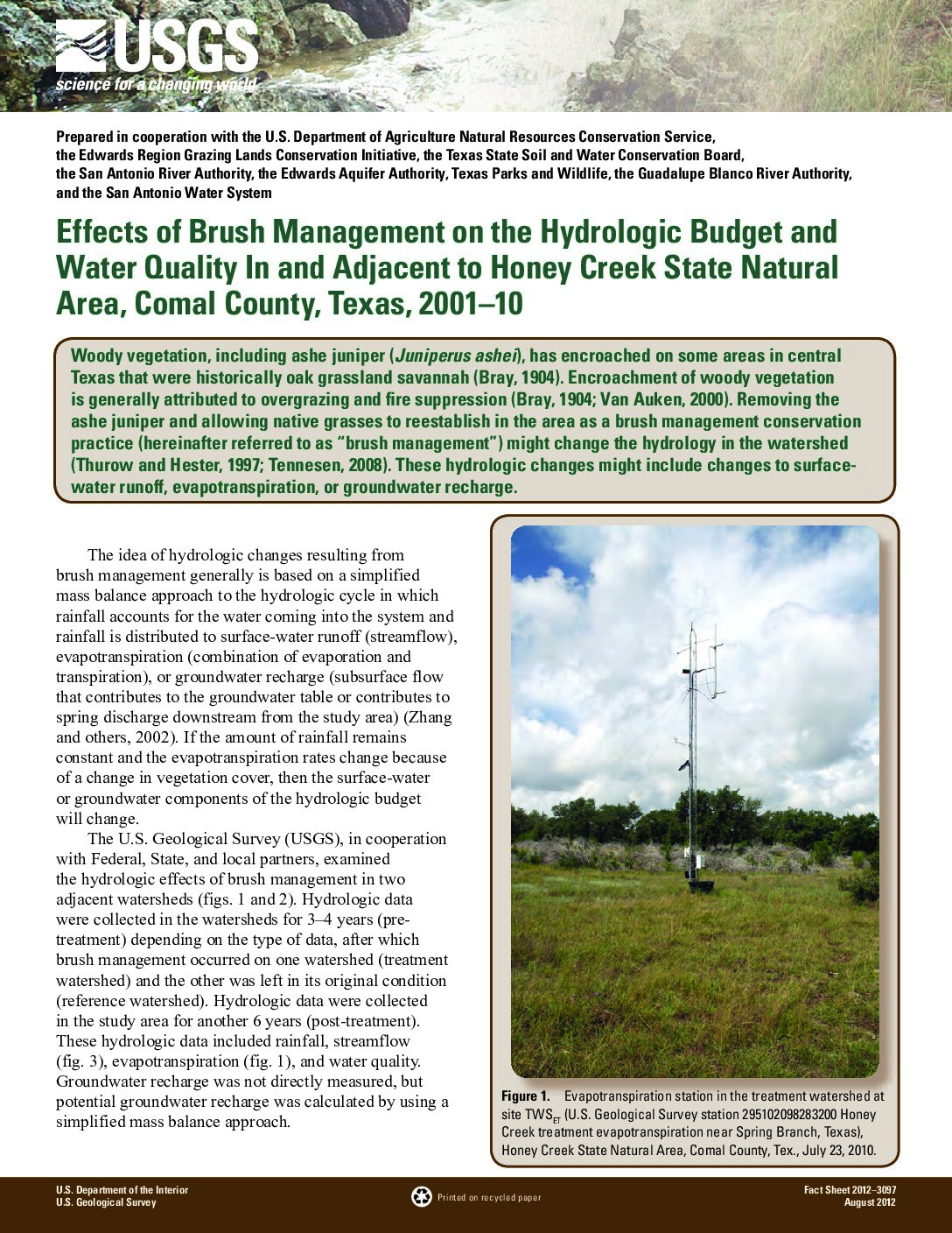
Description: Fact Sheet companion document to full report of the same name.
Location: Edwards Aquifer, Comal County, Honey Creek State Natural Area
Summary:Effects of brush management on hydrologic budget and water quality. May not be generalizable to all locations. See full report of the same name.
Development Of A Finite-Element Method Groundwater Flow Model For The Edwards Aquifer
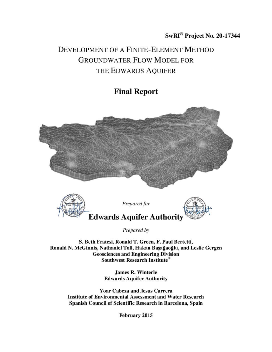
Description: Attributes of the alternative model that set it conceptually independent from the 2004 MODFLOW model are: ï‚· Inclusion of the Contributing Zone ï‚· Recharge is calculated directly from precipitation and is not prescribed at the upgradient side of the Recharge Zone ï‚· Western boundary is refined to better define the Kinney Pool ï‚· The Contributing and Recharge Zones are characterized by three layers ï‚· Distinct conduits are included in the Confined Zone ï‚· The alternative model employs a finite-element formulation instead of the finite-difference formulation used in the 2004 MODFLOW model
Report Number: 20-17344
Location: Edwards Aquifer - San Antonio Area
Summary:The Edwards Aquifer Authority relies heavily on groundwater flow models to characterize groundwater flow conditions in the San Antonio segment of the Edwards Aquifer and to serve as the basis for predicting impacts of water-resource management scenarios. Currently, the Edwards Aquifer Authority uses a MODFLOW finite-difference model developed in 2004 by the U.S. Geological Survey to perform these water-resource management analyses. There are recognized limitations and shortcomings in the 2004 MODFLOW model, including questions about the conceptual model on which the numerical model is based.
The Edwards Aquifer Authority undertook two initiatives to reduce uncertainty in models used to perform water-resource management analyses. One initiative was undertaken to advance the 2004 MODFLOW model through a series of recalibration exercises. The second initiative was to develop a second groundwater-flow model that is conceptually independent of the 2004 MODFLOW model. The objective of a second model is not to replace the 2004 MODFLOW model; but to provide an independent numerical tool against which to compare the 2004 MODFLOW model predictions. This report documents the development of the alternative numerical groundwater model of the Edwards Aquifer for the Edwards Aquifer Authority.
Tracing Groundwater Flowpaths in Kinney County, Texas
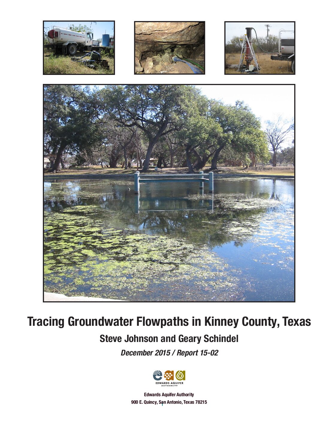
Description: This report presents the findings of a groundwater flowpath investigation in Kinney County, Texas, performed by the Edwards Aquifer Authority between 2007 and 2012.
Report Number: 15-02
Location: Edwards Aquifer, Balcones Fault Zone, San Antonio Segment, Kinney County
Summary:Results of the investigation revealed discrete groundwater flowpaths and relatively slow to rapid
groundwater velocities connecting the injection points to wells and springs. Apparent velocities from the injection point to each detection site ranged from two ft/d (one m/d) to 4,458 ft/d (1,367 m/d). These are straightline distances between dye injection and recovery points divided by travel time until the first detection of dye.
Because the actual groundwater flowpaths are certainly longer than straight lines, the apparent velocities underestimate the actual velocities. Injection points were Alamo Village Cave, HF&F Cave, Grass Valley PW-1, Whitney Cave, and Pratt's Sink in the north part of the study area; Dooley Irrigation Well in Pinto Valley; and Boerschig Well located approximately two mi northwest of Brackettville. Dyes from Grass Valley PW-1, Whitney Cave, and Pratt's Sink traveled radially to the south, east, and west, influenced by a structural embayment in the Edwards Aquifer that maintained relatively flat groundwater gradients. Deep flowpaths probably influenced by geologic structures resembling anticlines carried dyes southward to Las Moras Springs, a City of Brackettville well, and Fort Clark Municipal Utility District (MUD) wells. Groundwater chemical compositions vary at these locations, suggesting that there are discrete
flowpaths to each one. Dye from Alamo Village Cave traveled to Pinto Springs. Dye from HF&F Cave was detected in few locations. Dyes from the Boerschig Well were detected at Las Moras Springs, a City of Brackettville well, and Fort Clark MUD wells, although the detections seemed to change with groundwater head, Las Moras Springs discharge, or other factors. Igneous intrusions near Las Moras Mountain created a barrier to groundwater flow and diverted dyes westward toward Pinto Valley.
Status of Satan eurystomus Gubbs and Bailey, the widemouth blindcat
Description: Longley, G., and H. Karnei, Jr. 1978b. Status of Satan eurystomus Gubbs and Bailey, the widemouth blindcat. Endangered Species Report 5. U.S. Fish and Wildlife Service, Albuquerque, NM.
Report Number: Endangered Species Report 5
The Installation Operation and Analysis of Eddy Covariance for Quantifying Evapotranspiration
Description: This report summarizes the installation, operation, and data reporting of three towers using eddy covariance techniques to directly measure evapo-transpiration of water flux between the land and atmosphere.
Location: Bexar County, Uvalde County, Real County


