Conditions
Field Research Park
What Is The Field Research Park?
The Edwards Aquifer Authority, Field Research Park (FRP) is a 151-acre property that is located adjacent to Cibolo Creek on the Recharge Zone of the Edwards Aquifer in northeast Bexar County, Texas.
Research and Demonstration Activities
The FRP is a hub for groundwater-related sustainability and aquifer behavior research where EAA staff are demonstrating and evaluating various land management practices and their potential effects on aquifer sustainability. The hypothesis driving the work is that the practices offer potential for improved soil health, added soil water holding capacity, increased infiltration, and reduction of sediments in surface runoff.
Quantifying these effects is challenging, and the EAA has deployed multiple tools and methods designed to measure and analyze potential benefits of various land management techniques. Beyond our important research work, the FRP also provides a platform to share EAA’s mission and story with stakeholders, corporate guests, research partners and other interested parties. While much work remains, the FRP is integral to the EAA’s applied groundwater research efforts and is a platform for building important relationships.
Managed Aquifer Recharge
- Native vegetation
- Distributed/Diffuse recharge
Land Management Practices
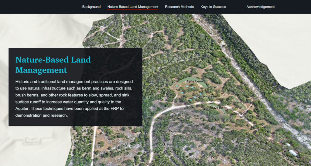
- Berms and swales
- Rock structures
- Brush structures
Soil Health
- Soil sampling
- Infiltration
Geophysical Characterization
- Boreholes (NMR)
- Well logging
- Resistivity
Data Collection
- Weather stations
- Eddy-Covariance
- Groundwater wells
- Stream gauges
- Soil plots
- Drone based remote sensing
- Pan evaporation
FRP Story Map